Unknown's avatar

About Chris Helzer

Chris Helzer is Director of Science and Stewardship for The Nature Conservancy in Nebraska, where he conducts research and supervises the Conservancy’s preserve stewardship program. He also helps develop, test, and share prairie management and restoration strategies. Chris is also dedicated to raising awareness about the value of prairies through his photography, writing and presentations. He is the author of The Prairie Ecologist blog, and two books: The Ecology and Management of Prairies and Hidden Prairie: Photographing Life in One Square Meter. He is also a frequent contributor to NEBRASKAland magazine and other publications. Chris and his family live in Aurora, Nebraska.

A simple tool for measuring grassland habitat structure (and digging holes)

Here’s something I’m trying to get off the ground. Or into it, I guess. It’s kind of ground-breaking, but not in the sense that it’s particularly innovative.

If you’ve been reading this blog for very long, you’ll know that I’m an advocate for habitat heterogeneity in grasslands. Both plant and animal species respond strongly to habitat structure (including height and density of vegetation, amount of bare ground exposed, coverage and depth of litter, and more). One great way to create heterogeneity is by providing a shifting mosaic of habitat that include a wide range of vegetation structure types.

This photo from my family prairie shows tall, dense vegetation. Note the spade in the photo and how much of it is obscured (more on this below). This is one type of vegetation structure, and is important habitat for some species, but it favors some plants and animals more than others.

Whether you use patch-burn grazing, open gate rotational grazing, or some other way of creating a shifting mosaic, the end goal is the same: to provide optimal habitat conditions for as many plant and animal species as we can. If you walk around a prairie managed in this way, you should be able to find examples of just about any prairie habitat type. If you walk that same prairie a year later, all those habitats should still be available, but in different locations.

The idea, of course, is to accommodate the needs of as many prairie species as possible to keep biological diversity high. Animals that need short vegetation and/or exposed bare ground are just as important as those that require tall, dense vegetation or ‘weedy’ patches with lots of short-lived broad-leaved plants. Hopefully, every animal should be able to find what they need at each of our prairies.

Similarly, some plants thrive best when most other vegetation has been suppressed by fire and/or grazing and there is less competition for light and belowground resources. Other plants are attractive to grazers like bison or cattle and need periods of no grazing to grow, reproduce and store energy.

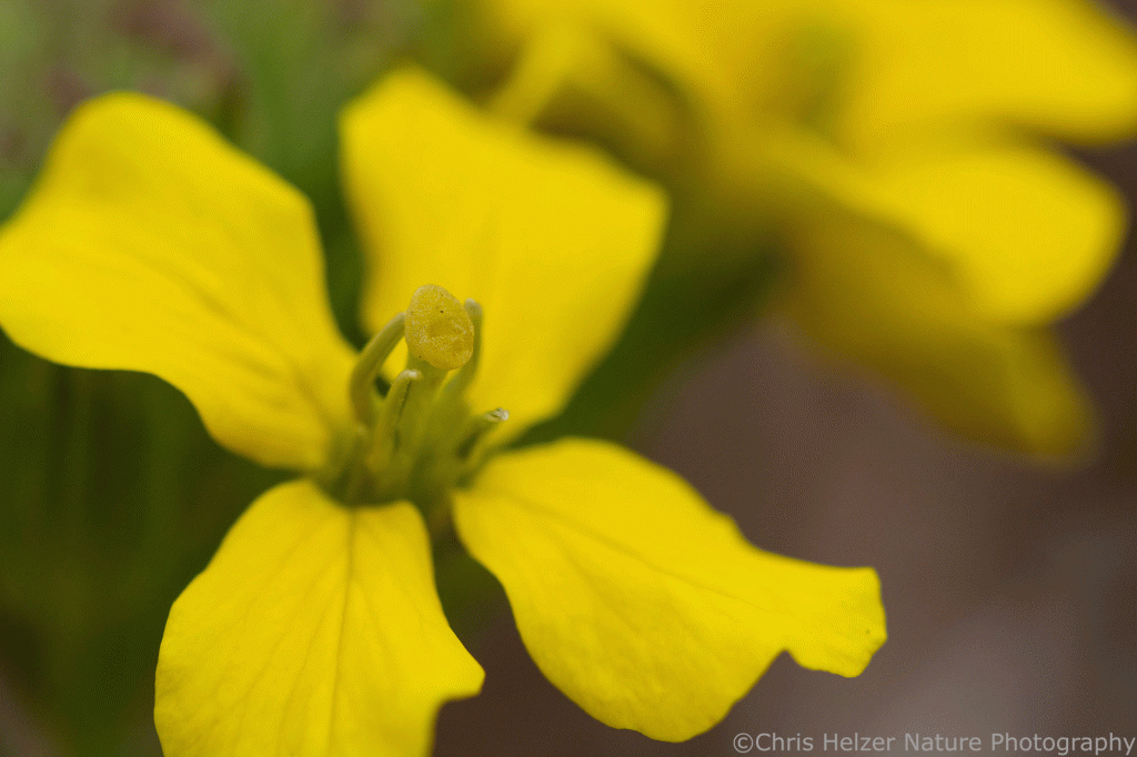
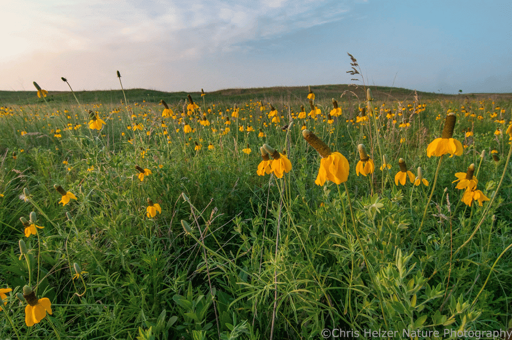
Plant species like Maximilian sunflower (Helianthus maximiliani) can usually grow tall and compete well with vigorous tall grasses in an ungrazed situation. In contrast, a species like upright prairie coneflower (Ratibida columnifera) may not do well when it has to compete with strong grass competition year after year. The shifting mosaic approach presents all plant species with continually-changing growing conditions so they can flourish every few years and, hopefully, sustain strong populations.

Upright prairie coneflower flourishes when grasses aren’t at full strength.

All of this brings me to the real subject of today’s post. If you’re like me, and you want to create heterogeneous habitat, it can be helpful to measure how well you’re doing that. It’s also nice to be able to compare habitat conditions between years or across multiple sites (including those managed by others).

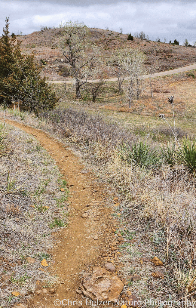
You could set up a rigorous sampling design and collect lots of intensive data, but most of us don’t have time or capacity for that. Alternatively, many people use photography to record what habitat looks like and then compare between locations and across time.

Photography is helpful, but it can be difficult to assess the density or height of vegetation from a photo. Including some kind of standard visual cue can provide useful context. There are lots of potential items you could use to provide that context. Some people use a ‘cover board‘ or similar tool that allows for exact quantification of visual obscurity. That’s great if you have a cover board with you all the time or if you’re conducting a research project. Most of us don’t and aren’t.

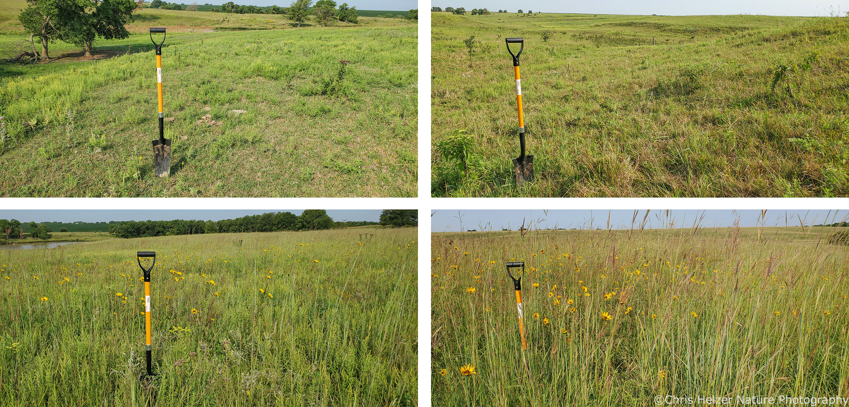
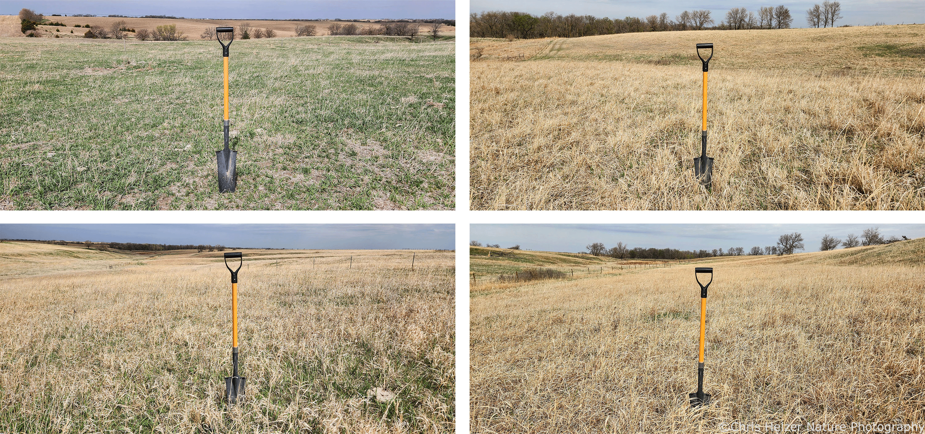
This is why I’m advocating for the use of a relatively-standardized tool for recording and comparing prairie habitat structure – the drain spade. It’s a tool most land managers own, and if you’re like me, carry around a lot of the time – for digging out invasive plants, if nothing else. There’s a little variation in blade and handle length among brands and styles of spade, but for the most part, a spade is a spade and it’s ok to just call it that.

Here are some summer photos from my family prairie in August 2020, showing the variation in habitat among the four main grazing paddocks at the site. By looking at how much of the spade’s blade and handle are visible, you can compare habitat structure between photos. This site is managed with an open-gate rotational grazing approach.
Here are four similar photos from my family prairie last week, showing how the habitat looks at the beginning of this growing season. The tall/dense patch is a little less tall/dense than in the 2020 summer photos, partly because of the recent drought and partly because snow and time break down vegetation over the winter.

I’m sure some of you are asking yourselves, “Can I use a round garden shovel instead of a drain spade?” Of course you can. You can use a grain scoop, a post-hole digger, a square point shovel, a nursery spade, or even a strain-reducing snow shovel with spring assisted handle.

For that matter, it doesn’t to be a digging/scooping implement at all. Heck, you could use a trash can, bicycle, or any other widely recognizable item, as long as you have access to the same item in future years. You can even use your nephew Harold (with consent) as long as he’s done with his growth spurt. But it might be nice to have us all using the same thing to make it easier to compare between our respective sites.

A drain spade is nice because it has a nice long blade so you can stick it far enough into the ground to hold the spade up without burying most of the blade. When I’ve shared this idea with others, I’ve been asked if there’s a standard depth to which we should bury the blade to best compare photos. Look, we don’t need to over-think this. There’s no need to be accurate to the nearest millimeter. We’re just taking pictures of a shovel.

If enough people start using this tool, we could send spade photos to each other. It would nice to see how the habitat created by other people’s management compares to our own. Maybe it would facilitate some helpful conversations about prairie stewardship tactics.

Here’s another series of photos from this spring at an open-gate rotational grazing site at The Nature Conservancy’s Platte River prairies. It shows a reasonably-good range of vegetation structure conditions across the site.

When I use my spade, I stick it in the ground so it stands on its own and then walk 4 steps backward and take a photo. I’m using my Android phone for the photography. I imagine an iPhone would also work but I haven’t tested for any potential incompatibility issues.

This turned out to be a longer post than I’d intended – especially since I’m really just advocating for people to stick a shovel in the ground and take a picture of it. I hope it’s helpful.

By the way, I’m sure some of you will be tempted to leave a comment below saying something about how much you dig this idea. Haha, very funny. Don’t bother. Why would you think I’d appreciate a comment like that? If you leave a comment like that now, it’ll just tell me you didn’t read this whole post.

Speaking of that, I guess you could use a post, too, if you don’t have a spade handy.

The continuing adventures of an ultrarunner’s crew member

Kim had another race at Wilson Lake in Kansas last week. It’s starting to become familiar territory for me after a couple races and training sessions there. Typically, at ultramarathon races, Kim runs many many miles and I wander around with my camera, making sure to be at the appropriate aid station every few when she comes through. I fill up her water, hand her some snacks, ask her how she’s feeling, and wave goodbye as she runs off again. It’s not the worst job in the world.

This race was a little different. All the runners were going around the same 4 mile (plus a little) loop over and over. They had to be ready re-start the loop every hour, on the hour. The last runner on the course wins. Sounds rough, right? I know! I had to be available EVERY hour, which really cut down on how far I could walk around with my camera. Plus, it was cold and very windy – and it rained for most of the morning. It was arduous, but I managed to get through it.

Lichen on a rock.

Once the rain finally stopped, the only challenges to photography (besides my limited travel range and free time) were the dark overcast skies and the strong winds. The clouds eventually started to break up a little, or at least lighten some, so I grabbed my camera and started making some short forays out into the nearby rocky, cedar-infested prairie to see what I could do in the fact of the wind.

One perk of the Wilson Lake landscape is that it includes a lot of rocks, and they’re big enough that even this weekend’s wind doesn’t move them around. Even better, many of the rocks host colonies of lichen, which do move, but VERRRY slowly, and are also unaffected by wind. They’re also very colorful and form interesting (to me) patterns. I spent some happy time composing photos of lichens and their rocks.

A very popular rock with lichens.
One of many rock outcroppings.
Another rock outcropping with lichens and moss.
My favorite kind of abstract art.
More art.

We’re just starting to see the first few spring wildflowers here in Nebraska, so I figured I’d see even more down south. There were a few, but not as many as I’d hoped. Part of that was probably due to the heavy thatch accumulation across most of the site. I did, eventually, find a few blossoms to photograph. I had to work on the south sides of steeper hills (or cedar trees) to have any chance of getting photos of flowers that weren’t whipping around impossibly fast. (Did I mention the wind?)

I think this is western wallflower (Erysimum asperum) but I’m not familiar enough with the possibilities to be 100% sure. See the wind-blocking hill in the background?
A closer view of the wallflower.
I believe this is a little introduced flower species called Filaree (Erodium cicutarium).

Another wind-resistant photo subject turned out to be a colony of ants and their mound. I came across a big ant mount along the race trail and watched it for a while. The cool weather (and the fact that I didn’t mess with the ants) seemed to keep the ants moving at a relatively sedate pace, but they were still quick enough to make photography a challenge. I managed to get a couple of sharp photos. I even broke down and did a little video work of them. It’s good for me to branch out now and then…

Here’s a photo and then a short video clip. (As always, if the video doesn’t work, click on the title of this post above to open it online.)

These mound ants (Formica sp.) had a nest right in the middle of the running trail so I had to time my photography carefully to avoid getting in the way of racers. I managed it.

.

Of course, I did also photograph Kim a few times. Besides fighting my cheap camera’s slow autofocus, the biggest challenge in doing that was to not look too much like a stalker…

Kim, about halfway through her race.
Here’s a relatively flat portion of the trail.

The last photo subjects I worked with were some early-blooming shrubs. Buffalo currant and wild plum were both flowering. I found that if I went to the downwind edge of a big patch of shrubs, the gale force winds were suppressed enough that I had half a chance of photographing flowers. The currant was a little more challenging than the plum since both the plants and patches were smaller.

I assume this is buffalo currant (Ribes aureum).

I was a little confused by the wild plum, and maybe some of you can help me. Much of the plum looked very familiar to me – the right size, appearance, and smell. But there were also some patches in which the height, stem diameter, and especially the flower size were much smaller than normal. They looked like a miniature version of wild plum. The flower diameter was maybe 1/3 the size of more ‘typical’ wild plum that I’m used to seeing.

I did a poor job of photographing the plants in a way that will help with identification (again – it was VERY windy). However, if anyone knows of a shrub that looks like wild plum, but smaller, let me know. I’m familiar with sand cherry and these didn’t look like that. The flowers are below. The first image is the regular-sized wild plum and the second shows the smaller flowers.

Wild plum (Prunus americana)
A smaller version of wild plum? Or a closely related species?

Kim eventually stopped running after 9 loops (about 38 miles). She could have kept going but she was mostly using the race as a training run for a 50 mile race next month, so she wasn’t ‘in it to win it’ this time. Even then, she finished as the second place woman (the first place woman ended up winning the whole race and ran a total of 125 miles!)

For myself, my legs got a little stiff from sitting in the car most of the morning and my knees got kind of wet while kneeling on the ground during the afternoon. I don’t think I’ll suffer any long-term effects, but thank you all for your concern.