This post is written by Kim Tri, one of our two Hubbard Fellows for this year. Kim is an excellent artist, as well as an ecologist, writer, and land steward. You can look forward to seeing more of her writing and artworks soon.
Sometimes, I have to remind myself that it’s in the name: Platte River Prairies, the collection of lands that we conserve. They are strung out and fragmented, but the Platte is what unifies them.
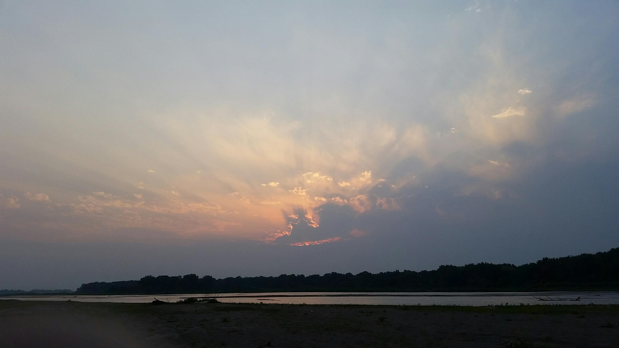
The Platte River at sunset. Photo by Pat Lundahl
It can be hard to see it sometimes. The river, altered as it is, follows its own sinuous course, dictated by geology, varying flow rates, and other natural vagaries. However, the roads we travel to reach our properties along the river follow man-made lines. Though the river laid down their sandy grades long ago, the roads were built on section lines and survey coordinates, east-west, north-south. (The exceptions in this area are Interstate 80 and the Lincoln highway, which roughly follow the river and the 19th century Mormon Trail.) Trying to follow the Platte along the county roads from one property to another involves a confusing handful of miles of zig-and-zag. These miles take long enough to travel on an ATV that it is easy to lose track of the river and the relative position of different tracts of land in this maze of right angles.
So, to keep myself straight, I build a mental map of the different disconnected pieces of land, re-centered along the river which ties them all together. It’s not very precise—there are no exact boundary lines and the distances are all approximate, but it helps me visualize the big picture.
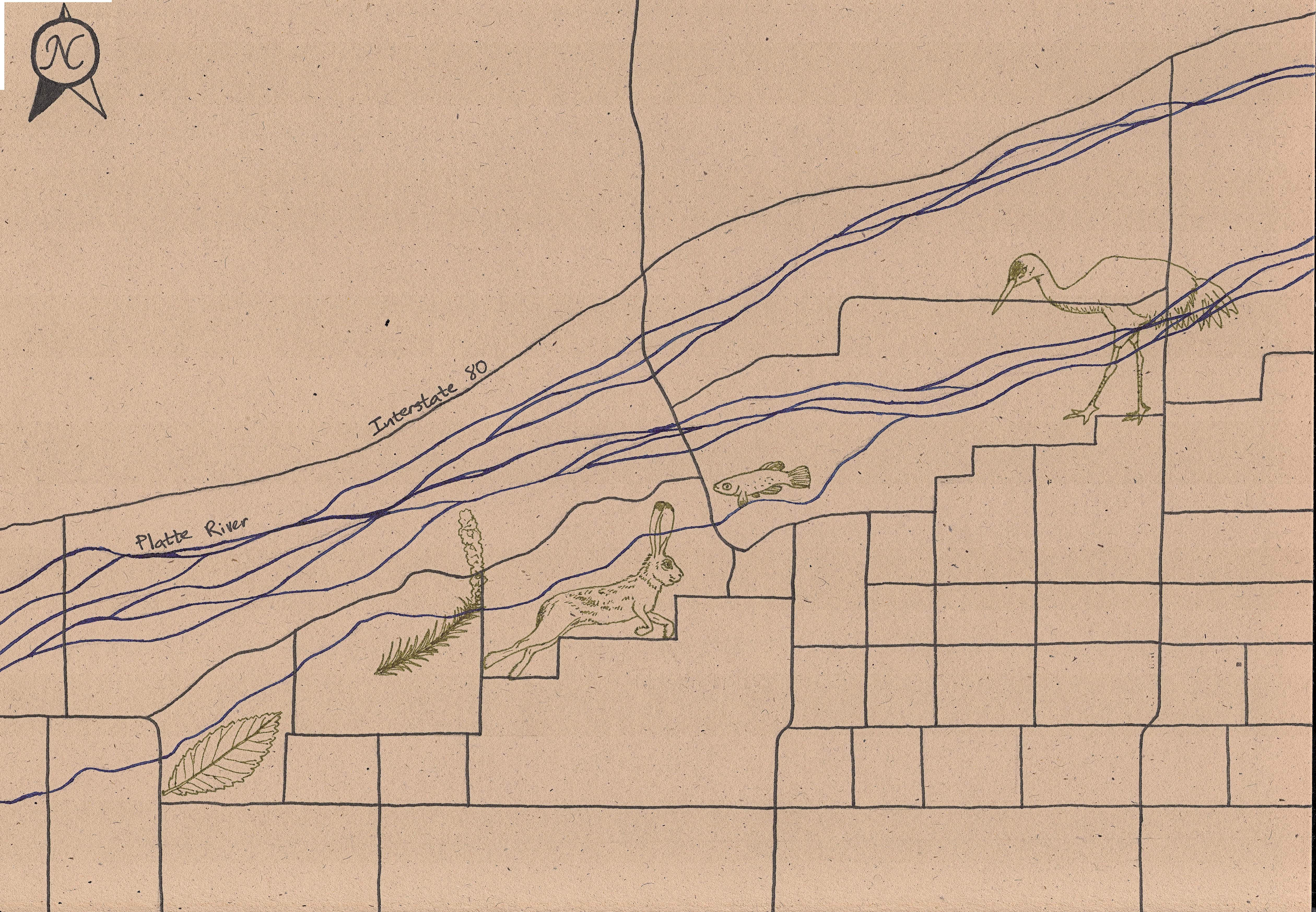
My mental map of the Platte River Prairies on paper. It covers roughly 14 miles west to east, with the river represented in blue, the roads in black, and collections of our properties in green symbols, which represent unique aspects of these properties. From left to right, the symbols are: Siberian elm leaf (invasive), tall gayfeather, black-tailed jackrabbit, plains topminnow, and sandhill crane. Map by Kim Tri.
Allow me to explain the map briefly. I chose to represent our properties, or collections of them, with symbols highlighting unique character aspects of the land tracts, rather than exact boundary lines, which aren’t really a part of my mental map. I’ll explain them from west to east.
Sometimes I think of the Bombeck property as Siberia, because it is way out there and has our worst Siberian elm (a non-native tree) invasion, which I’ve represented with a Siberian elm leaf. To the east of that is the Miller/Uridil complex, which is represented by a tall gayfeather, since one of the Uridil prairies has an abundance of gayfeather flowers. The black-tailed jackrabbit to the east of that covers the Derr and Suck properties, since that is almost exclusively where I see jackrabbits when they aren’t dashing across the road between cornfields. The plains topminnow on the right represents or Sandpit wetland restoration, a restored stream channel that serves as habitat for native (and non-native) fish. The last symbol to the east is a Sandhill crane, representing the Studnicka and Caveny properties, located next to the Crane Trust, and where we view cranes on their migration stopover on the Platte.
This map gives me a perspective that helps me make sense of the everyday, the right and left turns chasing the treeline that marks the river. It helps me to see that while our properties may have edges defined by man, the boundaries within which we work are defined by a natural watershed. And though our lands may not all be connected by land, they are still connected by the Platte. The water that flows through the Kelly tract—two hours to the west—also flows past the Rulo property along the Missouri river, below the confluence of the two great rivers.

Great blue heron and shorebird tracks along a sandbar. Photo by Pat Lundahl.
The Platte provides the focus of life here. It feeds the groundwater which fills our wetlands, spawning frogs and toads, watering the sedges and rushes. It draws much of the wildlife to its banks. A walk along the river last weekend yielded the tracks of raccoon, deer, bobcat, and otter mixed in with those of the shorebirds. Here and there were dotted the massive prints of a great blue heron. In the spring, the sandhill cranes will blot them all out. We are working to preserve all of this, as well as the tallgrass prairie which the river feeds, and which we walk every day.

What an artistic point of view!!! I will never see those prairies the same again.
Thanks Kim
Your map reminds me of the maps Stephen Packard makes for his sites. He always chooses descriptive place names so people know exactly where he is talking about when discussing site management.
I am in awe of the unique perspectives that each of the Hubbard Fellows brings to the study of the Platte River prairie, and what a great learning experience it is for those of us who follow this blog. Please know how grateful we are for the opportunity to learn from all of you!