This year’s Hubbard Fellows are nearing their final stretch with us. Dat has been a joy to work with this year. Coming from the east coast, he has thrown himself enthusiastically into the Great Plains, working hard to become familiar with both the ecosystems and the landscape in general. He has grown tremendously as a prairie land steward and contributed significantly to our conservation work in a variety of ways. Stay tuned for results of a research project he conducted to evaluate our wetland restoration efforts. In the meantime, this latest post is an example of Dat’s eager exploration of the Great Plains. All photos were taken by Dat.
If you google “backpacking in Nebraska”, there aren’t many resources available on the topic. Most of the results are short hikes that can be done in a few hours, with no options for primitive camping or water sources. Usual backpacking trips have reviews and ratings, guides, maps – I found nothing. I desperately wanted to go backpacking and explore Nebraska and the fact that I couldn’t easily find any information made me even hungrier. After a good amount digging and some help, I found an opportunity in the Panhandle of the state.
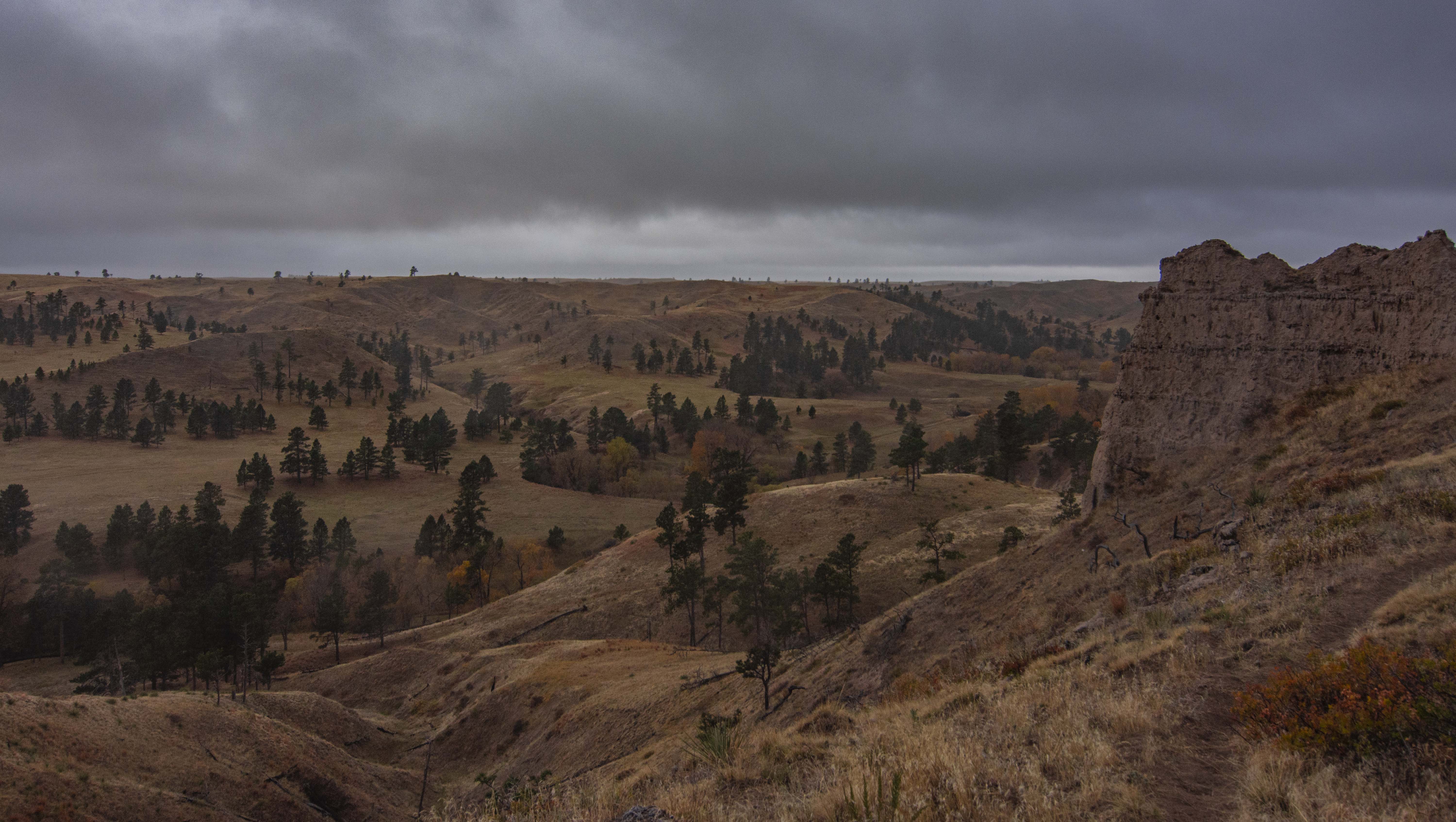
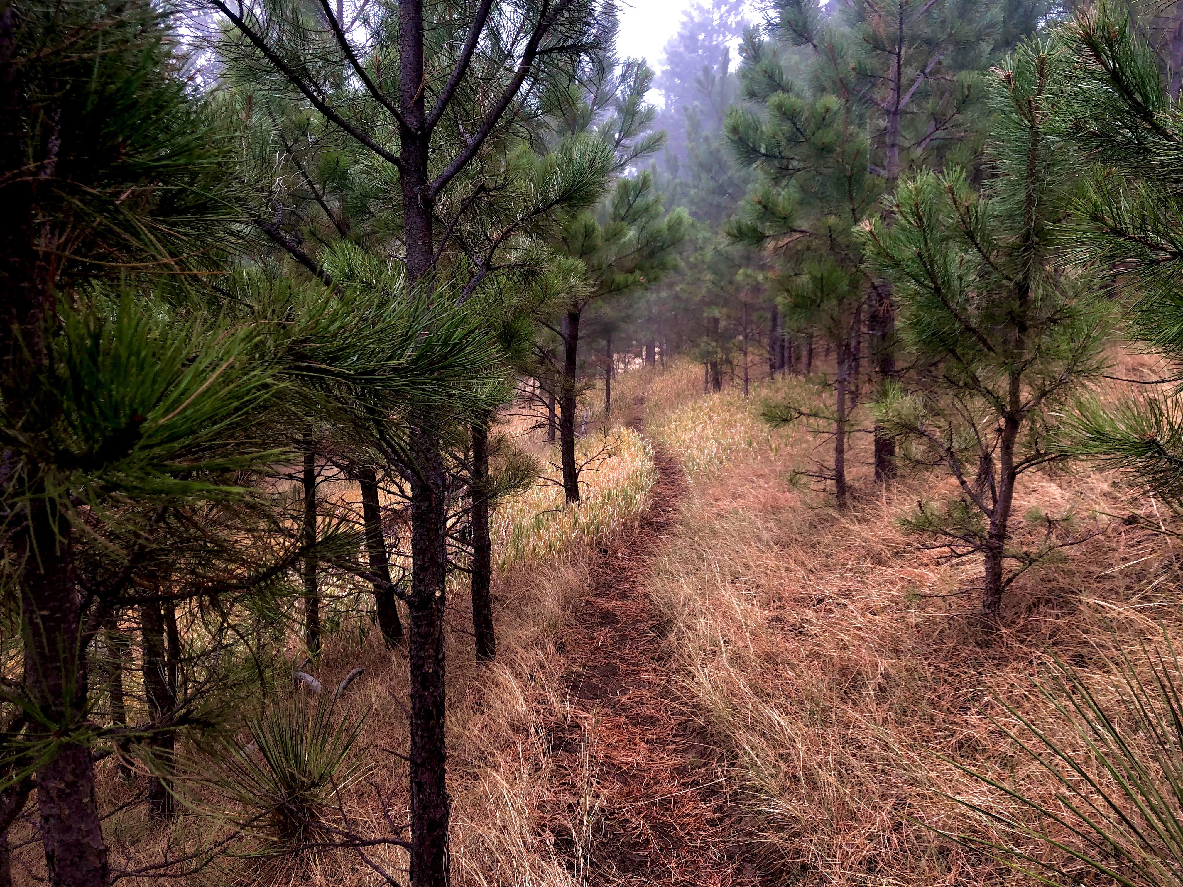
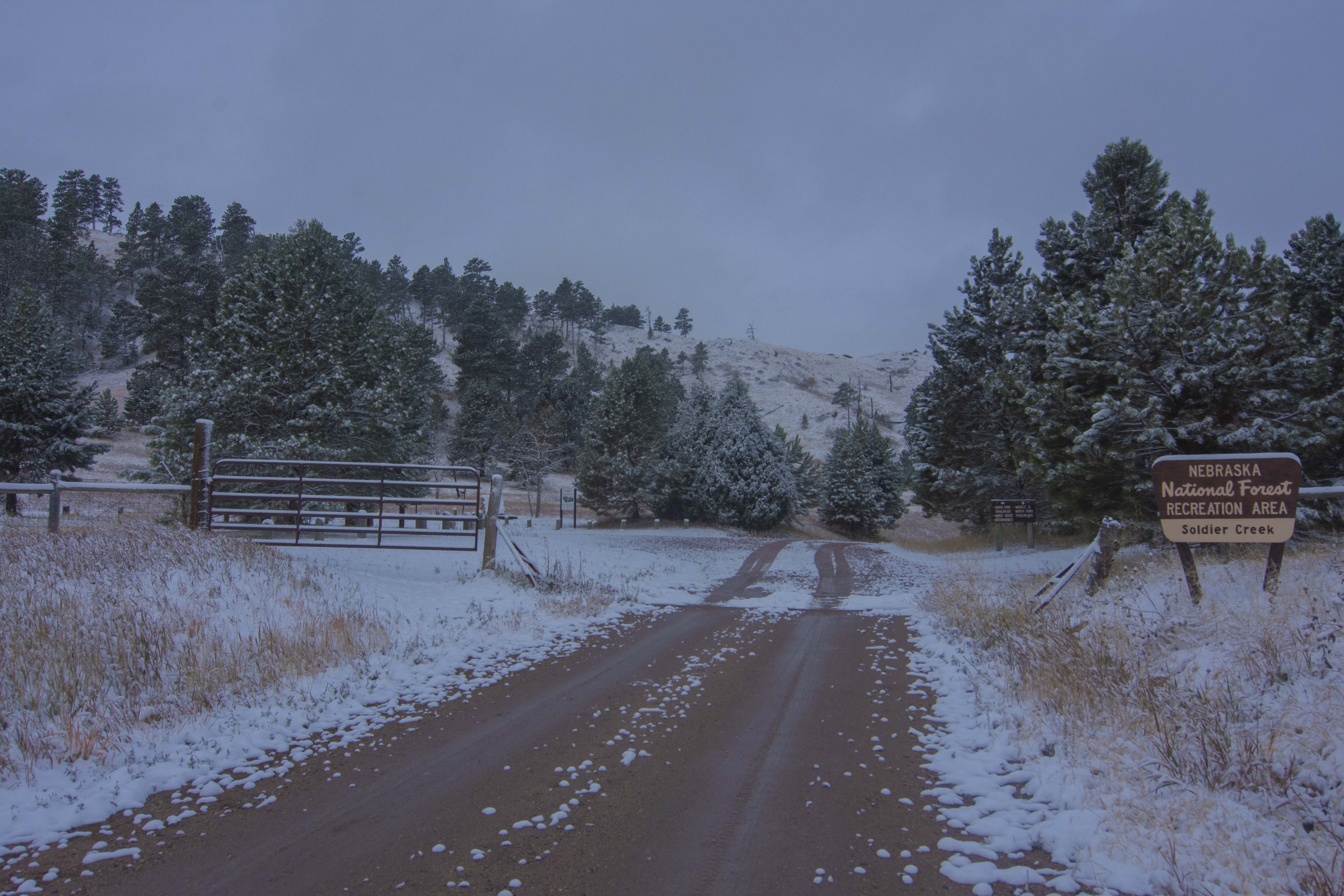
Driving into Fort Robinson State Park, escarpments cut through the landscape. Many years of erosion carve the landscape, and continue to do so. Down the gravel road, past all the trailheads and Johnson Lake, hides the National Forest – Soldier Creek Wilderness. This area used to be a sprawling Ponderosa Pine Forest, before a large wildfire wreaked havoc on the landscape in 1989. The area is mostly grassland now, but the pine trees are slowly recovering. Right before entering the campground and wilderness area, a shallow stream flows across the road – passable only with the toughest and most durable of vehicles. I was able to pass in my trusty Honda CRV without difficulty.
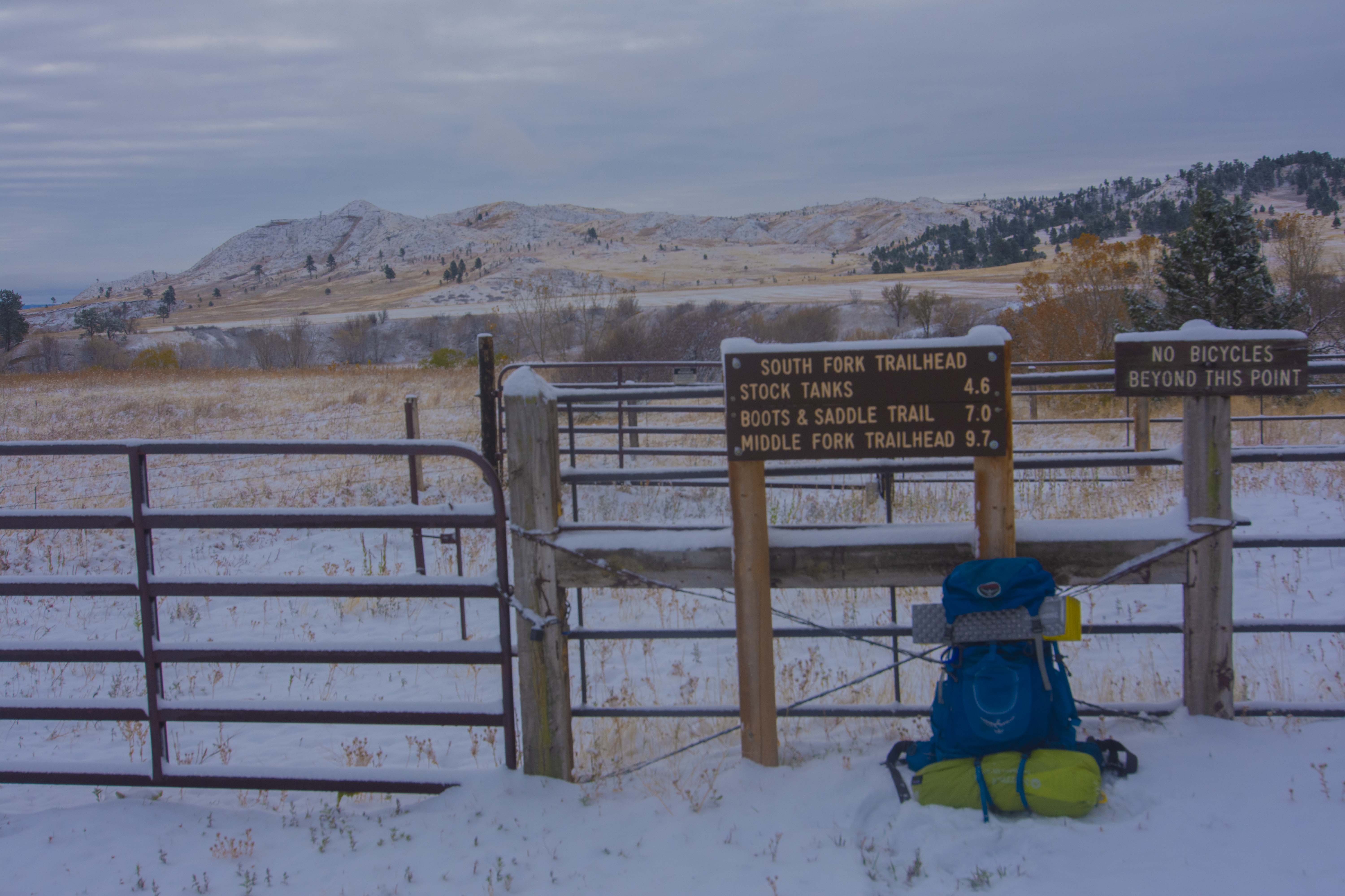
The Trooper Trail + Boots and Saddle Trail are two adjacent trails that combine to be roughly 18 miles – the perfect distance for a backpacking trip. I planned my trip to be two days and one night of backpacking. When I arrived at the trailhead parking lot, it was clear I wasn’t the only one eager to explore. As hinted by the name, horses and their riders often frequent these trails. The trailhead parking lot was filled with horse trailers as several people were preparing their horses for adventure.
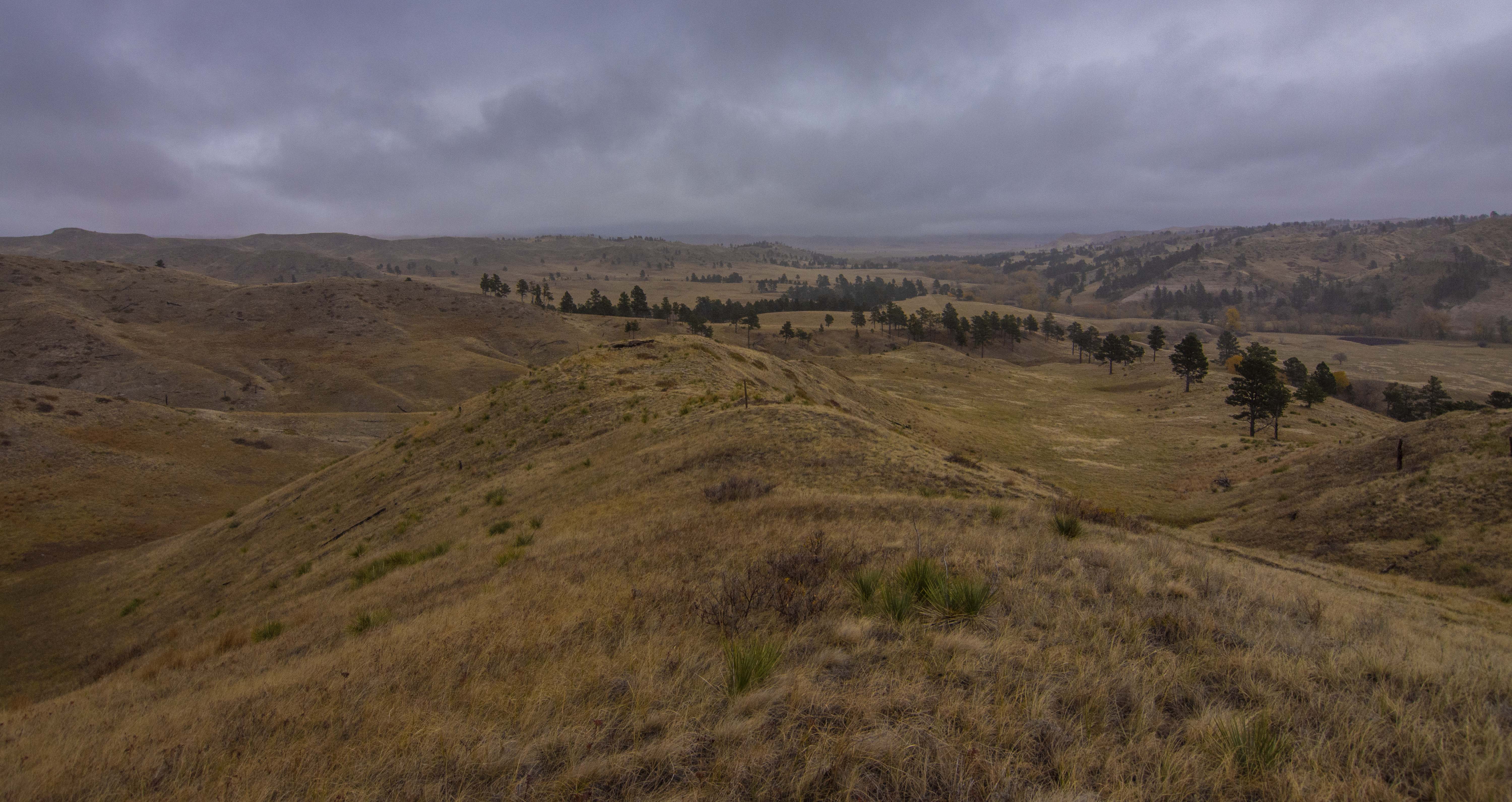
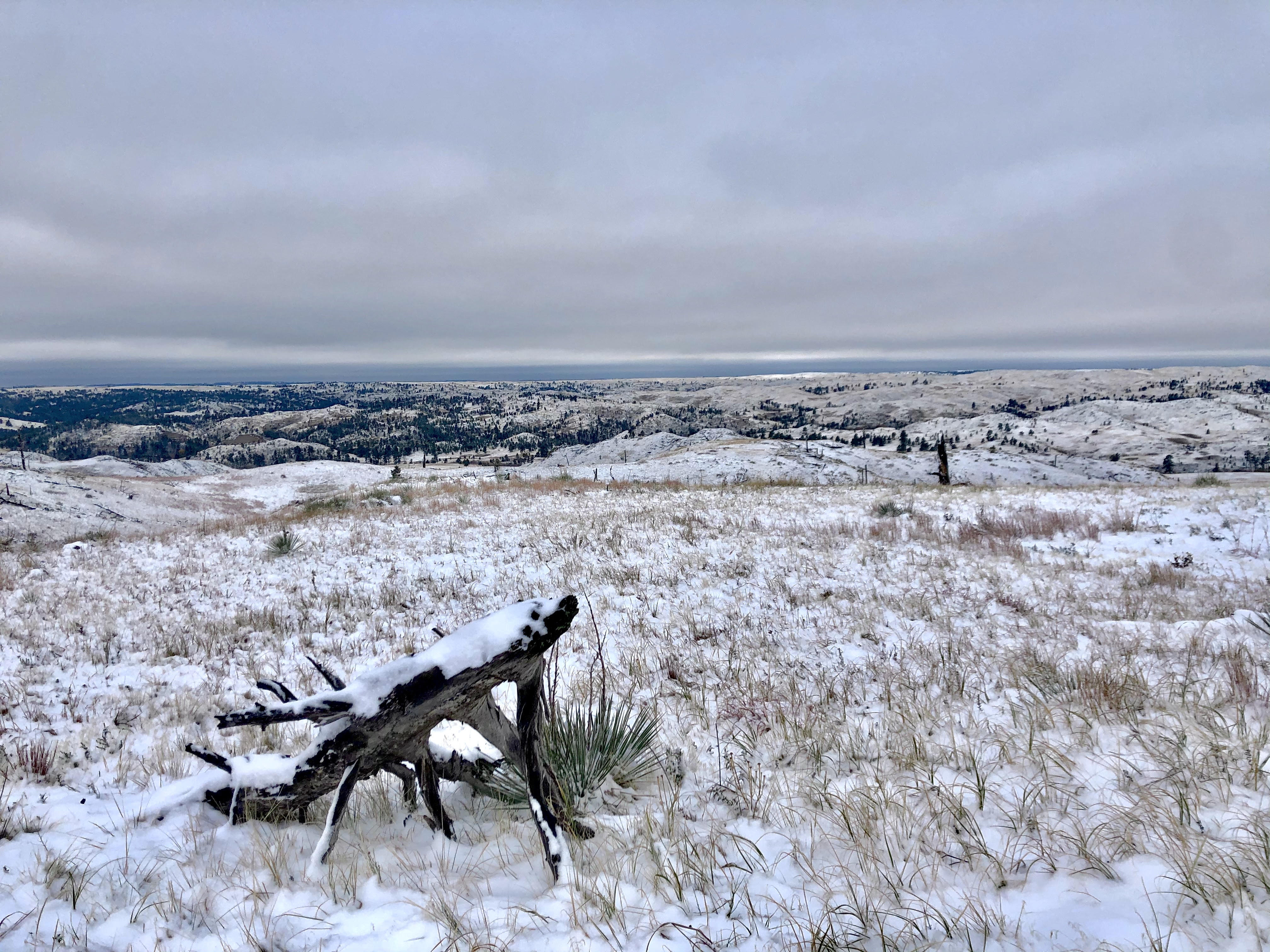
My journey started at the Middle Fork Trailhead and gradually led me counterclockwise on the Trooper Trail. The trail starts with a short ascent through and above the pine trees. To a view of canyons and rolling hills that dominate Trooper Trail for the next several miles. For most of the trail, I was on top of the ridge staring into the canyons and across miles of wilderness. Across the landscape, scattered burnt and fallen trees are accompanied by pockets of young Ponderosa Pine trees, hinting at the future generation of this recovering forest.
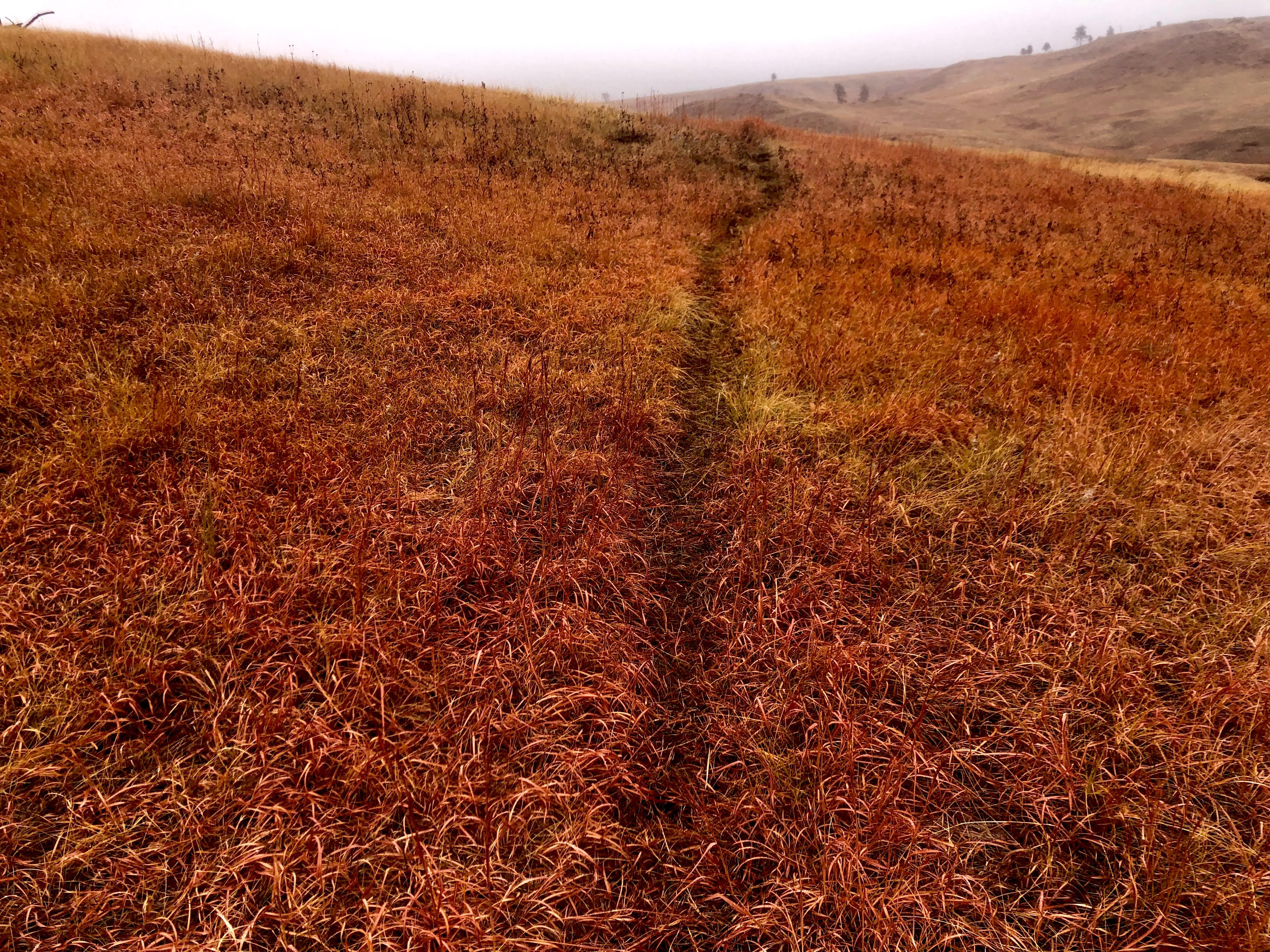
There’s a distinctive charm to autumn in grasslands. I couldn’t help but stop often to look around at the mixture of senescing grasses, seasonal foliage, and shorter shrubs added to the crisp autumn air. Coming from the vibrant autumns of the East Coast, I was amazed at the subtle yet beautiful grace of autumn in the grasslands.
The few miles after the cattle stock tank were my favorite. A short stretch of hiking along the top of a narrow ridge offers an inspiring view of the grasslands, recovering pines, and cottonwoods. Cottonwoods overwhelmingly colored the landscape as I descended into the lowlands and hiked along the streams. The yellow and orange hues of the cottonwoods complimented the dark greens of the pines and mixed hues of the grasses. As the sun slowly sunk below the rolling hills, I set up camp near the peaceful trickle of the surrounding creeks and prepared for the second half of my journey.
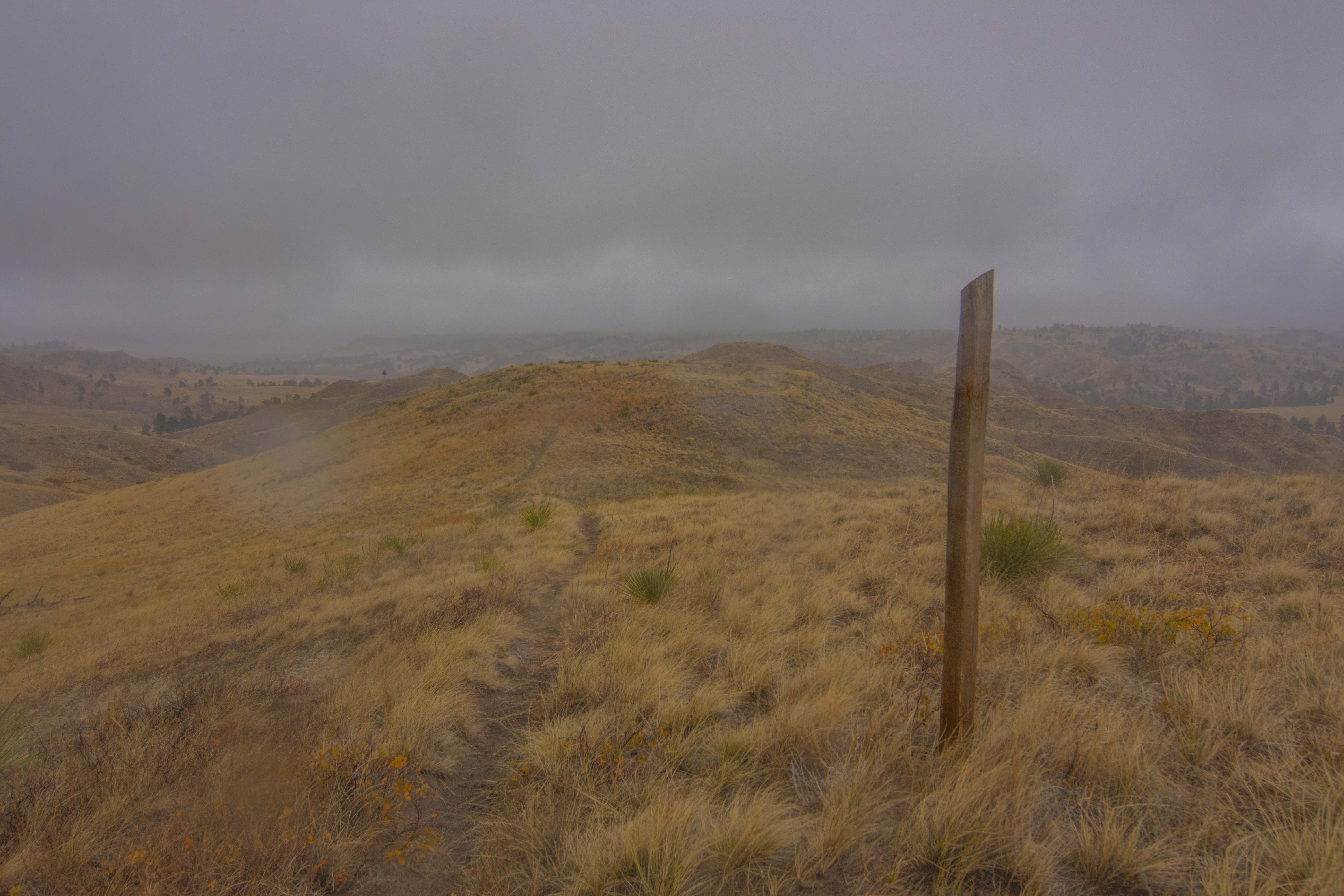
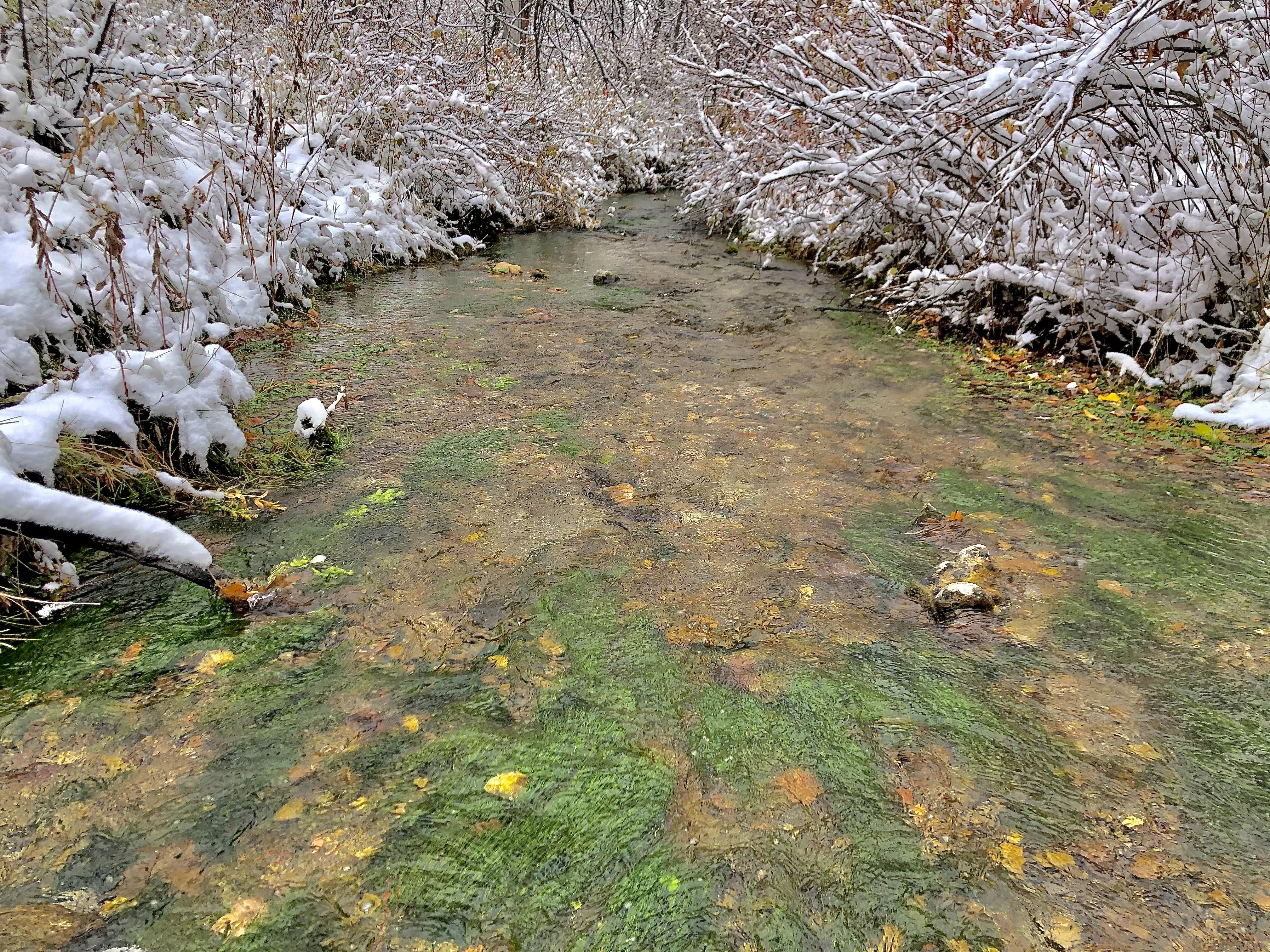
When I woke up the next morning, I was pleasantly surprised by the soft blanket of white that painted the ground and frosted the trees. I packed up camp and eventually made my way to the South Fork Trailhead. Now back at the campground, I proceeded counterclockwise along the Boots and Saddle Trail so I could see the Trooper Trail from the opposite direction. The first mile or so of this trail had several narrow stream crossings with the widest one right at the start of the trail. Inspired by my outlandish dream of becoming an Olympic long jumper or really just someone who could touch a basketball rim, I “elegantly” clambered my way across each crossing. Once I was out of the lowlands, I returned to the top of the world with rolling hills and valleys extending far beyond what I could see.
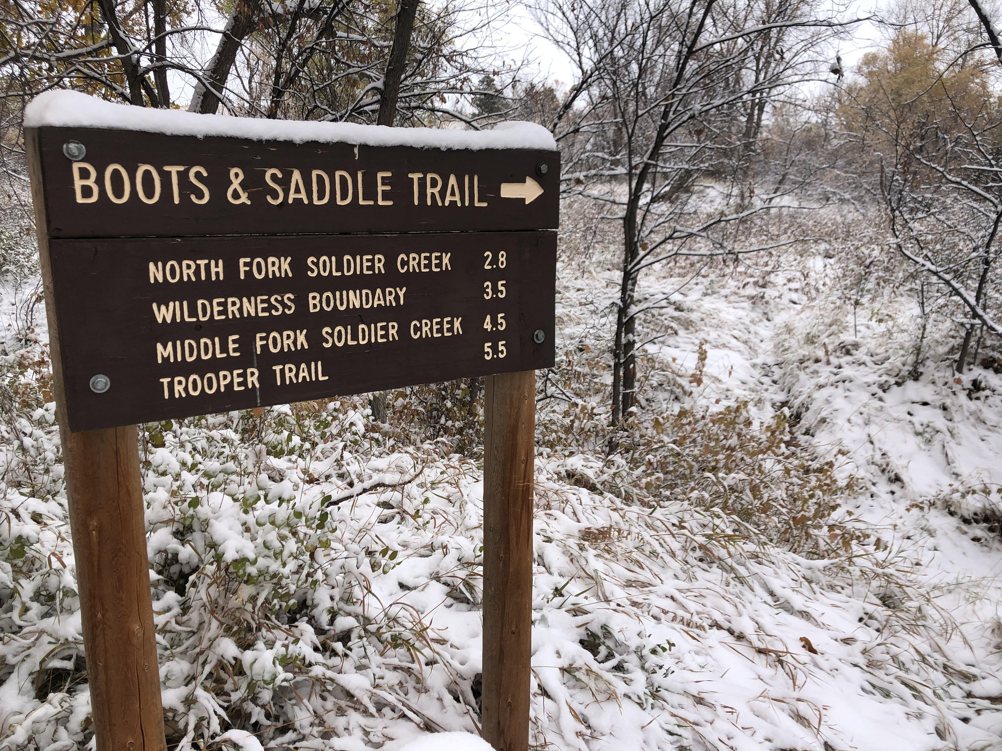
Wooden posts are the trail markers. It’s important to always be on the lookout for these posts, especially on the Trooper Trail, because sometimes the “trail” ends up being a cattle path or vehicle 2-track. The Boots and Saddle Trail, to me at least, seems to have more hoofed traffic so the path is clearer. I’ll admit that I lost the path several times but was able to find wooden markers to guide my way back.
When I made it back to my car, I was disappointed that the trip was over, but elated that I had this opportunity to backpack and explore this part of Nebraska. I find something oddly liberating about leaving everything behind and carrying just the essentials on my back for a few days. This experience was especially liberating because I got to explore a place not often visited by others. Nebraska certainly offers these escapes and I’m excited to keep finding more.
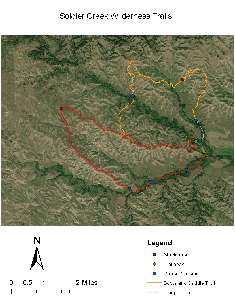
My route with map (there are real maps located at the South Fork Trailhead) –
1) Start at the Middle Fork Trailhead and take a left to go on Trooper Trail going counterclockwise
2) 2.5 miles to intersection and 5.1 miles to windmill stock tank – dominated by rolling hills
3) Rolling hills continue for another mile or so before switching to steeper canyons
4) Mile 7-10 lowlands, cottonwoods, and creeks – perfect place to find a place to camp since it’s flat and close to water
5) Back at the South Fork Trailhead (at this point you can restock or switch out whatever gear at your vehicle, stop completely, or keep going)
6) Continue on to the Boots and Saddle Trail going counterclockwise (sneakily hidden east of the campsite by the Middle Fork Trailhead)
7) Cross several creek crossings for next mile or so
8) Ascend to the top of the hills, rolling hills for most of the Boots and Saddles Trail (in my opinion steeper than the Trooper Trail)
9) Another good camping spot I would recommend is near the first stream crossing closest to the intersection between the 2 trails – flat areas near pine trees
9) Reach the intersection between the two trails, 2.5 miles until the Middle Fork Trailhead