After the 2012 wildfire that swept through the Niobrara River Valley in north-central Nebraska, one of the concerns among our neighbors and other observers was the chance of significant erosion from both wind and water. Based on previous experience with summer fire and grazing in Sandhills prairie, we weren’t overly concerned about erosion there, but we had less experience with the kind of steep slopes and loose soils found beneath the ponderosa pine and eastern red cedar trees on the bluffs north of the river. We used timelapse cameras to watch several areas where we thought there was potential for erosion to happen. (Spoiler alert: not much happened.)

One of our timelapse cameras, set up to watch the downwind edge of a big blowout in bison-grazed Sandhills prairie. After this photo was taken, fence panels were erected around the base of the camera post to keep bison from rubbing on it.
One camera was set up on the edge of a big Sandhills blowout (an area of bare sand created by previous wind erosion). With a summer of severe drought, a July wildfire, and continuous bison grazing during and after all of that, it seemed possible we’d see some accelerated wind erosion there. The camera was erected in April 2013 and set to take one photo per hour and document whether or not the blowout expanded in size following the fire.
The camera’s post twisted and shifted some over time (watch the distant bluffs in the top left corner of the images as a landmark). That made it more difficult to track the edge of the blowout precisely, but it’s clear that if there was any expansion of the blowout, it was really minor. This matches what we’ve seen previously after conducting prescribed fires (spring, summer, and fall) in bison-grazed prairie in the Sandhills. Although ranchers are often advised to defer grazing after a fire to avoid damaging grasses and/or causing erosion, we haven’t seen any long-term problems arise from grazing immediately after fires. Graduate research by Jack Arterburn at the University of Nebraska-Lincoln is helping us further evaluate the recovery of grasslands from this latest wildfire.

Jeff Dale, of Moonshell Media, installs a timelapse camera on a steep slope north of the Niobrara River beneath fire-killed pine and cedar trees. Looking at Jeff’s feet versus the base of the tree he’s working on gives you a feel for the steepness of the slope.
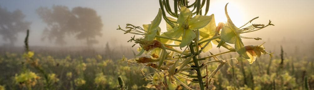
North of the river, the wildfire ripped through stands of ponderosa pine and eastern red cedar that had become so dense that very little vegetation could grow beneath many of them. Following the fire, the barren ground and steep slopes seemed ripe for significant soil erosion. We had several cameras in this area to help see how much erosion actually occurred. One of those (shown above) was set to look across a steep slope in a place that seemed particularly likely to lose soil during a downpour.
Some small gullies formed, and a few rocks even washed downslope along with some topsoil during spring rains in 2013. After that, however, annual plants of various kinds established quickly on the slopes and subsequent soil loss between the summer of 2013 and the end of the season in 2015 appears to have been very minimal. Perennial plants are now starting to spread across these slopes, but it will be a while before they are the dominant vegetation. In the meantime, annual sunflowers, foxtails, and other short-lived opportunistic species seem to be doing their jobs and holding the soil.

This camera was deployed to record sediment coming off the steep slopes on the bluffs and into the bottom of this draw.
We also put a camera at the bottom of a draw beneath the steep slopes shown earlier. Any water and/or sediment coming from those slopes would have to flow into and through this draw, so we thought it would be a good place to watch. In the first video below, you can see that a load of sediment did come down between May 18 and May 21, 2013 – the same time period during which we saw the most significant erosion in the video of the steep slopes. The other story from this particular video is that you can really see the resprouting of the bur oak trees in that draw – nearly all of which seemed to survive the wildfire (albeit in a different form than before).
In the second video from this camera, you can see a quick progression of images from the three years following the fire. The tall growth of vegetation (primarily annuals) makes it difficult to see the ground, but there doesn’t seem to be any evidence of erosion after that first half season of 2013. We didn’t do any seeding or take other steps to reduce erosion on steep slopes, so it was reassuring to see that the plants there were up to the task of holding the soil. Amanda Hefner and Dave Wedin from the University of Nebraska-Lincoln have been collecting data from the site that we hope corroborates the story we’re seeing through the cameras.
It would have been a lot more exciting to show you videos of blowouts moving across the Sandhills or torrents of rock and soil washing down steep slopes. Sorry about that. On the other hand, while we won’t likely win any awards for dramatic videos, watching nothing much happen in these timelapse images is pretty powerful in its own way. It’s natural to assume the worst after a traumatic event like a major wildfire, and it can be difficult to convince ourselves and others that things will be ok without some pretty strong evidence. Timelapse photography is only part of our effort to measure the impacts of the wildfire, but they provide visual reassurance in ways that data graphs just can’t.
We’ll continue to watch and react to the recovering landscape in the coming years. For now, however, recovery of the Niobrara Valley Preserve seems to be on a good track.
Thanks to the Nebraska Environmental Trust for supporting our timelapse project other efforts to measure and track recovery from this wildfire.

Great post Chris! I think it is also important to realize that not all erosion is bad – it has occurred on even the most natural of landscapes for eons. No doubt that some wildlife (plants and animals) are adapted to eroded areas or depend on the results of erosion in nutrient movement. Excessive erosion may be a problem in some landscapes.
An excellent point, and you’re absolutely right. Erosion certainly creates excellent habitat for important animals, plants, and natural processes.
Thank you Chris, there is a lot of information in this post.
I may have erred in timing, but it seems to me that the silt deposit was much slower in re-vegetating than slope from where the soil eroded. if that is the case, it seems that eroding soil damages it’s topsoil qualities more than the in the damaged soil remaining.
I’m very interested in finding studies on surface water flow and water absorption rates of different prairie types. Could you point me in a direction please to find these?
Thanks so much!
Mary.
You are going to find results all over the place because soil absorption varies not only by vegetative type, but maturity, vigor, residual plant matter and underlying soil character. Recent studies by the UNL geology department indicate that from the beginning of flowering until seed hardening, any plant will use all the available ground moisture and it will take several months to recharge most soil profiles in the root zones. In general ground water recharge can be expected during the period after plant dormancy and before seed development, provided the soil is not frozen or exposed in a manner that generates rapid runoff. Since lakes in Nebraska can evaporate five feet of water annually and the land receives far less, it is apparent that puddles and open soil actually evaporate faster than plants transpire.
Prairie type responds to management. After the Dust Bowl, the mixed grass prairie moved 200 miles east. The same can be done with grazing management. Management can also have a profound impact on runoff rate or water absorption.
Mary,
I took a long trip today, so I gave your question some thought.
Are you interested in long term water yield or short term flood events?
Long term water yield is complicated by some shift in 1920’s or 1930’s that resulted in dramatic reductions in flow in the Niobrara and the Republican. Land use? Measurement system? No one I have talked to knows why, but it did contribute to the Republican River compact issues.
Flood events:
The Sandhills Almanac has a great article on Sandhill Rivers and hydrology and how stable the Loup River flow is, never varies by even double. The Niobrara is almost as stable. Other rivers typically rise and fall by 10, 100 or even a thousand fold after a rain.
Rainfalls of 4 inches in the ponderosa pine forests can generate floods large enough to take a block wide swath out of Rapid City or any place in Colorado. After the Colorado Springs fire, a half inch rain could close US 24 and flood Manitou Springs. A four inch rain in the short grass prairie and fields around Ogallala can close I-80. A 4″ rain on the Loup Basin is just a ground water recharge event. The same is true on Gabe Brown’s field near Bismark, ND. But a week of rain of about 8″ on the plains of Montana and record high snow pack resulted in the record Missouri Flood that kept the river running record high and wild for a summer.
I suggest you visit with the Corps of Engineeers. They have some pretty sophisticated information that they use to generate Flood Plans, but I think it may not be more precise that grassland, forests, field or pavement and soil map type.
Although the sand blowout did not expand much, I believe I am seeing the blowout get deeper and a crescent dune increasing in height in the back.
The small amount of erosion on the slopes is probably because the plants root systems remained intact after the fire even though the trees had been killed.
This is a great project Chris. Mother Nature has a tremendous affinity for healing after catastrophes, e.g. Mt. Saint Helens. Even though I won’t be around, hopefully pines will someday re-establish the Niobrara slopes.
As a retired geologist interested in sustainable agriculture, I think that these videos are important contributions to our understanding of erosion after significant perturbations. We do need the graphs of hard data, but we also need these “optics” to inspire the efforts and expense of systematic data collection out in the field. Thanks for another helpful post.
Pingback: Photo of the Week – April 7, 2016 | The Prairie Ecologist