As promised, I’ve gotten through my photos from last week’s wildfire and can give you a more complete report on the status of our Niobrara Valley Preserve. The fires in our area are now out, and most of the smoke has cleared. The entire wildfire complex (four separate fires, treated as one by the firefighters) burned about 74,000 acres. The biggest fire was the Fairfield Creek Fire, which burned almost 67,000 acres, and that is the fire that affected our Preserve. In total, almost 30,000 acres of the Niobrara Valley Preserve were burned. Below is a map that shows the boundary of the Fairfield Creek fire.

Map created by Rich Walters, The Nature Conservancy. You can click on this and other images/photos to see them more clearly.
.

The view last week from the north “mountain” at the Niobrara Valley Preserve. This photo looks southwest toward the headquarters and the sandhills beyond.
There are at least two ways to look at the aftermath of this wildfire. The first is to focus on the destruction caused by the fire. The second is to focus on what survived, what will recover, and the overall resilience of the ecosystems and people affected. I’ll do both.
DAMAGES
The actual damages caused by the fires are mostly human related. Several of our neighbors lost their homes and most of their personal possessions. Those are certainly the most severe of the losses from the fire. None of our Preserve staff lost their homes, but a couple did have property damage and losses from the fire, including loss of grazing income from their own land and the destruction of personal belongings that were stored in a building that burned.

Damaged bison fence along the south side of the river.
On the Preserve itself, our most significant structural losses were the many miles of fence that will have to be rebuilt and/or repaired. Ironically, we had a good stockpile of fenceposts, harvested through our cedar control efforts at the Preserve, but those were all burned as well! It’s still too early to know the full extent of other damages to windmills, waterlines, and other scattered structures on the 25,000 acres or so of the burned areas within our boundaries. In addition to structural damage, our program at the Preserve relies significantly on income from grazing leases associated with our sandhills prairie management. About 700 cattle had to be shipped home, putting a strain on the owners of those cattle, and greatly diminishing our lease income for this season.

The headquarters of the Preserve escaped the fire unscathed, thanks to a lot of work by Conservancy staff and other fire fighters.
.

Very large areas of pine woodland burned in the bluffs and canyons north of the river.
.

The view from a lookout point along the Preserve’s south hiking trail.
.

Burned sandhills prairie in the east bison pasture.
.

Burned woodland north of the river.
SURVIVAL AND RESILIENCE
Ecologically speaking, the ecosystems along the Niobrara are built to withstand and recover from fires – even severe fires like these. Things will be different, but it’s not really accurate to talk about those changes in terms of destruction.
The biggest changes will take place in some of the pine woodlands on the north side of the river, where crown fires wiped out large areas of trees. Through a combination of seeds already present in the soil, seeds from the few surviving trees within those burned stands, and seeds from nearby unburned areas, the pines will reestablish themselves – but it’ll be several decades before the area begins to function as a woodland again. In the meantime, those areas will be dominated by grasses, sedges, and wildflowers, and eventually shrubs and small trees. While thousands of acres of pine woodland burned, many more thousands of acres along the river are still standing, providing abundant habitat for the species that rely on them.

These pine woodlands will look very different in the coming decades than they have in recent years.
The oak savannas on the lower slopes near the river will look pretty different as well. In some areas, most of the oaks will probably die from the intense heat – especially where eastern redcedar trees were abundant in the understory. Those areas will become more open grasslands, with scattered surviving oaks. Over time, more oak trees will re-establish. However, on the north side, and especially on the south side of the river, many oaks will survive, and the fire will have removed much of the underbrush beneath them. Those more open oak woodlands will support a more diverse community of plants and animals than they did before the fire.

Some of the oaks along the lower slopes north of the river will likely recover, but the overall community will much less wooded and more dominated by herbaceous plants.
On the south side of the river, the woodlands burned very unevenly. In a few places, the fire roared through the crowns of densely packed cedar trees, taking out pines, oaks, and other trees with them. This will create some openings in the previously continuous woodland that will provide habitat for those species that thrive in sunshine. Over time, those areas will close back in with trees, or remain open, depending upon how they are managed through future use of controlled burns and other techniques. Many parts of the woodland south of the river didn’t burn at all – or burned only at low intensity through the leaf litter beneath the trees. Those areas that burned at low intensity will see an increase in the grasses, sedges, and wildflowers growing in the understory, adding to the diversity of those areas and the woodland as a whole.

This portion of the south hiking trail (south of the river) experienced very little fire. The birch trees and other species growing in the cooler wetter areas – especially near streams – will probably not feel much impact from the fire.
.

The area around these pines south of the river burned at a low intensity, so these trees should survive.
At least half of the acres burned in the fire were grasslands – particularly the sandhills prairie south of the river. Anyone familiar with prairies knows that fire is an important part of prairie ecology, so this fire will not be anything these prairies haven’t seen before. While the broad extent of the fire will mean that some animal and insect species will have to recolonize burned areas from relatively long distances, that colonization will be helped by scattered unburned patches within the larger boundaries of the fire, and by the many thousands of acres of unburned prairie that wrap around the south side of the Preserve (not to mention the 11 million acres or so of sandhill prairie that cover about 1/3 of Nebraska!)

Pockets of unburned habitat within the burned sandhills will help with survival and recolonization by insects and animals. This blowout area was too sparsely vegetated to carry fire.
.

This tiger beetle was one of many insects that were crowded into blowouts and other small pockets of unburned grassland.
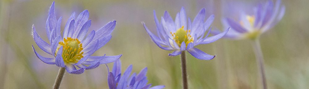
The fact that this fire took place in the summer makes it different from most controlled burns that occur in the spring or fall, but we’ve conducted summer prairie fires on the Preserve in the past, so we can predict the results of this one with some confidence. Summer fires suppress the vigor of those plants most actively growing at the time, and invigorate those plants that can move in quickly to grab territory from those suppressed individuals. During the next year or two, there will be an extra abundance of short-lived plants in the burned prairies, but that will subside as the perennials recover and reassert their dominance. The speed with which those perennials recover will be regulated by rainfall. In the meantime, visitors to the Preserve should be treated to quite a wildflower show!

Lizards like this juvenile six-lined racerunner were still easy to find within the burned areas of the sandhills last week. Almost any source of shade seemed to have a lizard under it during mid-day.
.

Grasshoppers were also abundant in and around remaining patches of vegetation.
.

This patch of prairie is in the east bison pasture, and didn’t burn in the wildfire because it had been burned in a controlled burn this spring. Between the spring fire and subsequent bison grazing, there wasn’t enough dead grass to fuel the wildfire. This and other patches of unburned prairie were loaded with insects and other prairie animals, and will support quick recolonization of burned areas as their vegetation recovers.
.

A walking stick insect on silky prairie clover.
.

A sweat bee on plains sunflower in an unburned patch of prairie.
NEXT STEPS
Since the end of the active fires, the main jobs for the staff of the Preserve have been to assess the damage and do some immediate repairs to the bison pasture fences. Since cattle have been shipped out of the cattle pastures that burned, we can focus strictly on the bison pastures in the near term. We think (hope?) we’ve found and returned all the bison that wandered through the downed fences into the adjacent cattle pastures (still on Conservancy land). Now we have to keep them in! I don’t think final decisions have been made about what to do about the east herd, which doesn’t have much unburned grass left, but the west herd should be able to get through the season on what they’ve got to eat.

Staff of the Nature Conservancy from Nebraska and South Dakota worked together to repair bison fence last week. The work continues this week…
Longer term, there will be many miles of fence to rebuild, and other infrastructure to repair. More importantly, we need to do some thinking about how best to take what we’ve been given and use it to our advantage. One of our biggest challenges prior to the fire was the widespread encroachment of eastern redcedar trees. Now that we’ve had a sudden and substantial reduction in our cedar-invaded acres, we want to be sure we design and carry out a plan to prevent reinvasion. We also want to design some evaluation and tracking protocols to see whether/how our prior cedar control efforts affected the intensity or spread of the wildfire, and follow the recovery of the various ecosystems in and around the Preserve over time. Finally, we’ll need to spend some time considering the changed ecological character of the Preserve, and change our management/restoration strategies to match the new situation. It should be a busy but exciting time.

A stand of cedar trees that was effectively controlled by the wildfire…
.

We’ll need to spend some reevaluating our management plans for portions of the Preserve that will have very different ecological communities in the near future.
.

The river continues to flow, and the scenery is no less breathtaking following the fire. While we’ll need to adjust some of our thinking and our strategies, the overall value of the river valley and the Niobrara Valley Preserve remains unchanged.
HOW YOU CAN HELP
We’ve been flooded with offers of help during the last week or so, and we’re very appreciative. Unfortunately, most of the work that needs to be done in the short term isn’t well suited to volunteer labor. The remoteness, expansiveness, and difficult terrain of the Preserve make finding and repairing fence quite a chore even for those very familiar with the area. That, combined with our limited facilities and staff to host large numbers of volunteers, makes it hard to accept help from the many people who have offered. I think most of the physical repair work will need to be done by staff and contractors, but we will certainly try to find ways to use your labor as well. Stay tuned here and to the Conservancy’s Nebraska website for more information. You can also email Jill Wells at jwells@tnc.org to put your name on a list of potential future volunteers.
On the other hand, our greatest need is, and will continue to be, financial. If you’re interested in supporting the next phases of restoration and management at the Niobrara Valley Preserve, you can donate online by following this link or by calling 402-342-0282. Thank you.

The Niobrara River winds through the Niobrara Valley Preserve just east of the headquarters. This photo was taken three days after the wildfire. It’s just as beautiful as before – just different.

Not bad for a blog
Chris,
Very helpful and informative. Maybe TNC-NE should do a Fence Fundraiser…it could be called…
Adopt-a-Fence, or Please Fence Me In, or the Big Fencing Match…
I think this is an excellent post! You have given us much specific information about the land, the flora and fauna, and the prospects of recovery of many species and their habitats – and the work involved. I learned new things – for instance, the need to control redcedar. As a native of Nebraska, I know the love of and concern for that home country doesn’t ever go away. Thank you, Chris. Take care. Keep us posted!
Great post and fantastic photos! I think you have painted one of the most thoughtful wildfire narratives of the year. It would be interesting to look into mapping the patterns of post-fire burn severity observed on the ground as compared to satellite imagery in relation to vegetation and grazing patterns.
I would be interested in seeing some before fire, fire damaged and post fire yearly staged photos of how an area recovers and changes. Sometimes we want nature to be the same and “preserve” what is there. But nature is uncontrollable and has it’s own purpose. Fire, is one of those aspects of nature that can leave us with benefits in the future. Good post.
Chris,
Thanks for taking the time to write this post and include so many photos. I have no experience with summer fire and was interested in what you had to say. What a great opportunity to track the changes over time at such a large scale. Do you know if there will be any monitoring of the aqatic life in the river itself?
Todd Strole
Todd – thanks. I haven’t heard of anyone talking about monitoring the aquatic aspects of the fire impacts, but it’d be interesting. I’m not much of an expert on the aquatic side of things, but I could imagine some short term pulses of sediment and possibly nutrients because of the changes in vegetative cover, especially on the steep slopes north of the river. ON the other hand, because it’s not an agricultural landscape, I would think that would be much less of an issue than in some places to the east. On the other other hand, what do I know? I’m a prairie guy!
We’ve seen huge problems with erosion after the clearing of invasive trees. This is something that should be expected after this fire.
Chris- The National Park Service has a program called the Inventory and Monitoring Program. One of the aspects of the program is to monitor water quality. I oversee that program, and we have been conducting WQ monitoring on the Niobrara for the past couple of years. Please feel free to contact me if you would like further information. I think we will see some interesting results from pre- and post-burn.
WI experience suggests your oak areas may become a thicket of oaak grubs.
Fine report, from all perspectives.
And from the ecosystem perspective — what an exciting time for the next few years — to follow the recovery and richness of a fire-dependent ecosystem that very much appreciates this opportunity to burn more like it once did.
It will be a priority place to visit. And, Chris, I hope you’ll be able to give us many more updates (probably with many great surprises) over the years.
Thank you for update on a place that we really care about. Very informative. I actually feel somewhat better about the fire than I did before. I would urge TNC not to reduce the east bison herd (at least too much). Along with adopt-a-fence, maybe we could have a “support a bison through the winter” financial campaign I would hope you can continue to inform TNC members about what is going on at NVP.
Thank you for sharing hope…and for sharing with us your eye for this beauty!
Great photography, but we’ve all come to expect nothing less from you. Damn good ecology lesson on the role fire plays in our part of the world (and careful enough to not get run out of town). And maybe best of all, good documentation. I’m sure folks will be looking at your photos 10 years and 50 years from now comparing how the land comes back. Hope you do the 10 and 20 year revisits, and maybe the 30th.
Agreed with Jon F. above, about comparing photos. To add to that theme (and to put a bug in anyone with funding’s ear), it would be extremely interesting to compare the bird communities post-fire to our UNL research project’s data from 2004-2005. Summary of that can be found at: http://snrs.unl.edu/powell/research/Frost_Powell_11_earlyview.pdf The essence of the findings–cedar has an impact on shaping bird communities. One would expect the communities to change after the fire. I would be especially interested in the ovenbirds, which appeared to benefit from the closed canopy provided by the cedars (pretty odd, but it is pretty odd that they are in a linear, high-edge forest in the first place).
Excellent pictures and post. Austin and I revisited an area several years ago in the Black Hills that burned in 1988. Definitely a different habitat now.
Thanks for sharing these amazing photos and everything in about the fires. I hope this drought doesn’t get the best of us–it won’t though, we’re a strong state!
great pictures, are the fire breaks that were made during the fire going to be kept up?
any thought about making more fore breaks to aid in future fire fighting?
Brad – good questions. I don’t have all the answers. I’m pretty sure we won’t be maintaining the lines that were disked through our properties, but will be conducting prescribed fires as we can – which will function as firebreaks as well. In the future fires like we had this year (that jumped the river four times) will probably not be stopped by firebreaks except in large areas of low fuel. More importantly, we (all of us) probably need to think more seriously about reducing fuel levels in woodlands up and down the river to help prevent this kind of large uncontrollable fire from happening again. Thinning woodland areas – particularly of smaller pines and cedars that allow fire to jump from the surface level up into the crowns of the trees – seems like an important strategy going forward. Even if we can’t thin everything, thinning some large areas here and there can help function like firebreaks and provide places for firefighters to fight future fires in lower intensity conditions. Trying to maintain permanent firebreaks seems like a difficult task when it’s impossible to predict where fires will take place. Also – the area that burned this time will likely not see that kind of intense fire for quite a few years into the future (most of the trees that intensified the fire are gone now) so firebreaks in those areas might not be that useful.
What resources showed up? Did you get help from the Ft. Niobrara refuge, or TNC’s fire use module? Shot crews? Looks like it got hot with the sustained crown fire. Look on the up side, now you can replace the cedar fence post with metal and not worry about them during the next Rx season.
Trent, there were hundreds of firefighters from federal crews and volunteer depts around Nebraska and Iowa. Lots of help.
Pingback: Wildfire Recovery at The Niobrara Valley Preserve – Asking The Big Questions | The Prairie Ecologist
Pingback: Best of Prairie Ecologist Photos – 2012 | The Prairie Ecologist
Pingback: Capturing Post-Wildfire Recovery Through Timelapse Photography | The Prairie Ecologist
Pingback: Wildfire Recovery at The Niobrara Valley Preserve – Spring Green Up | The Prairie Ecologist
Pingback: Watching the Sandhills Bounce Back at the Niobrara Valley Preserve | The Prairie Ecologist
Pingback: A Visual Update of Wildfire Recovery at the Niobrara Valley Preserve | The Prairie Ecologist
Pingback: Fenceline Timelapse | The Prairie Ecologist
Pingback: Timelapse Bison Photos | The Prairie Ecologist
Pingback: Photo of the Week – September 18, 2014 | The Prairie Ecologist
Pingback: Continuing Wildfire Recovery at the Niobrara Valley Preserve | The Prairie Ecologist
Pingback: A Walk in What Used to be Woods | The Prairie Ecologist
Pingback: Wildfire and Erosion (Or Not) at the Niobrara Valley Preserve | The Prairie Ecologist
Pingback: Photo of the Week – April 7, 2016 | The Prairie Ecologist
Pingback: Photo of the Week – July 28, 2016 | The Prairie Ecologist
Pingback: A Long-Awaited Fire | The Prairie Ecologist