I’m in the Nebraska Sandhills all this week, doing field work. Being in the middle of 12 million acres of intact native prairie has its advantages, but there’s not much time or internet connectivity for blog posting. I’m hoping I can get a few photos posted here pretty quickly before I lose my connection again.

Yucca is common throughout much of the Sandhills. Many of the plants are in full bloom right now, accompanied by the yucca moths that pollinate them.
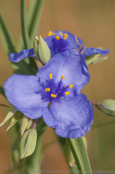
Spiderwort (Tradescantia occidentalis) is also in full bloom right now. It is one of my favorite flowers.
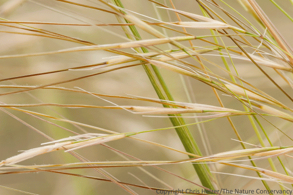
Needle-and-thread grass (Hesperostipa comata) is producing seeds, which look very much – and can act very much – like sharp spears. Trying to figure out why this grass is blooming abundantly in some pastures and not others has been a fun mind puzzle for me this week.

Platte thistle (Cirsium canescens) is a great native thistle with a cream-colored flower. It is loaded with pollinators right now.
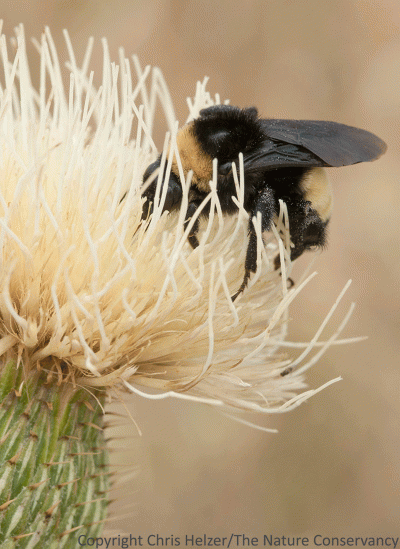
This bumblebee was one of many bees I’ve seen enjoying Platte thistle.

Wetlands are all over many parts of the Sandhills. Groundwater levels are high and often exposed between the vegetated sand dunes. The wetlands are loaded with everything from frogs and salamanders to trumpeter swans and grebes.

Lizards are common, especially in areas of bare sand. They scurry to cover as we approach, but this prairie lizard (Sceloporus sp.) posed long enough for a photo.