For the second time in two weeks, I got to travel west into drier, shorter prairie. This week, our crew attended the Nebraska Natural Legacy Conference in Gering, Nebraska – at the far western end of the state. While there, we explored both Scotts Bluff National Monument and the other parts of the Wildcat Hills. A significant portion of this beautiful rocky landscape has been conserved and opened to public access by a partnership called Wildcat Hills Wildlands, a partnership between Platte River Basin Environment, The Nature Conservancy, and the Nebraska Game and Parks Commission. It is a spectactular and under-visited part of the world.
I caught the sunrise at Scotts Bluff National Monument yesterday, and then joined a tour of the Bead Mountain Ranch in the afternoon. Here are some photos from those two places.

As the sun turned the sky pink in the east, the moon was dropping in the west. Scotts Bluff National Monument.

A closer look at the moon just before it dropped behind the bluffs.
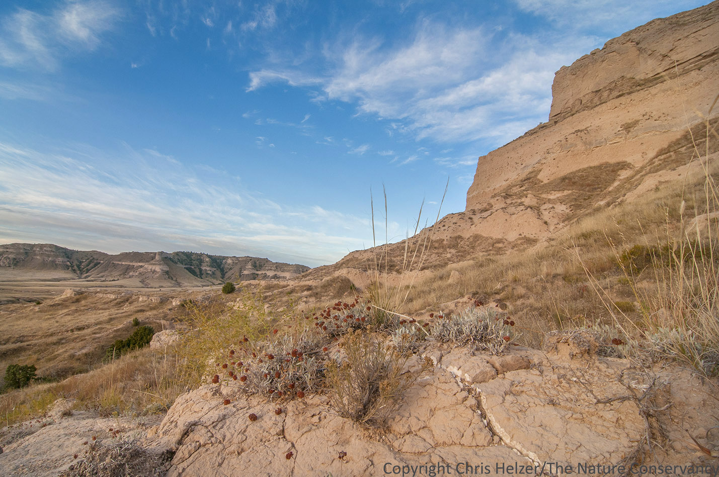
After the sun finally rose, it mostly stayed behind filmy clouds, providing beautifully warm and soft light on the rocky landscape. Scotts Bluff National Monument.
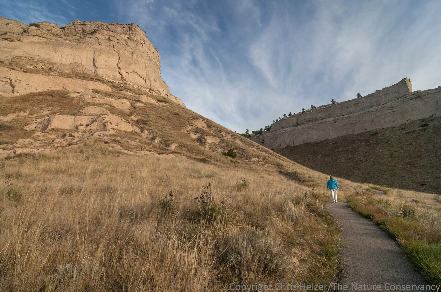
A hiker enjoys the paved trail and gorgeous weather at Scotts Bluff National Monument.

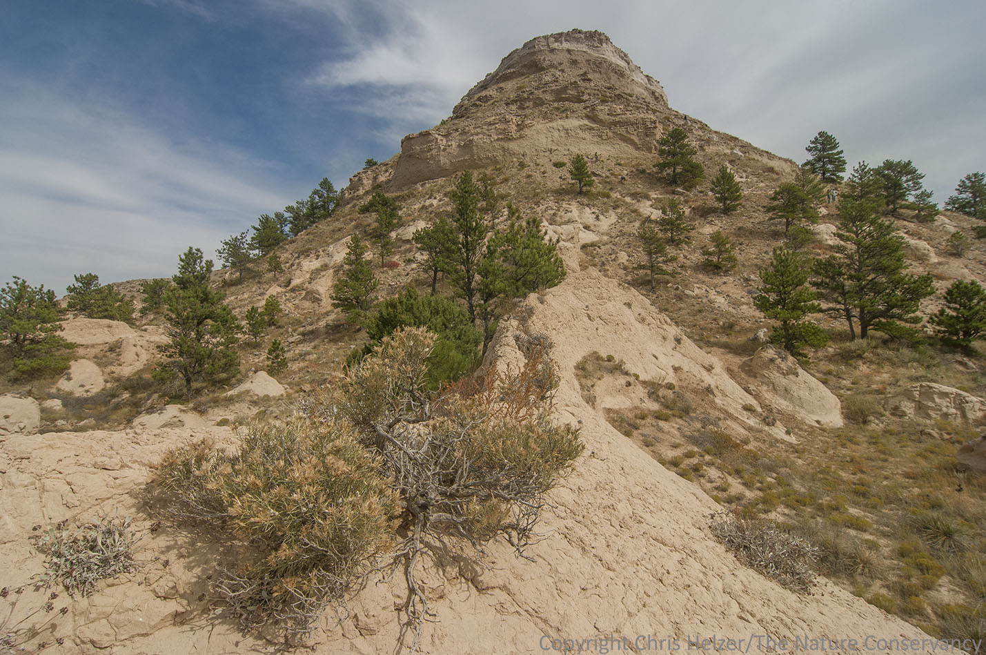
More from Scotts Bluff National Monument.

Ten-petal mentzelia (Mentzelia decapetala) on a dry slope.

A multi-image panorama at Scotts Bluff National Monument. The noted landmark Mitchell Pass is on the far left.

A large group from the Nebraska Natural Legacy Conference tours Bead Mountain Ranch – part of the lands owned and managed by Wildcat Hills Wildlands.
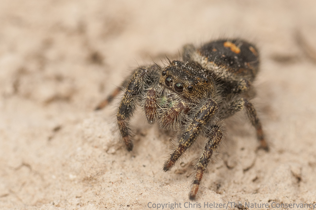
This little jumping spider was hunting on the sandstone face of the rocky bluffs.
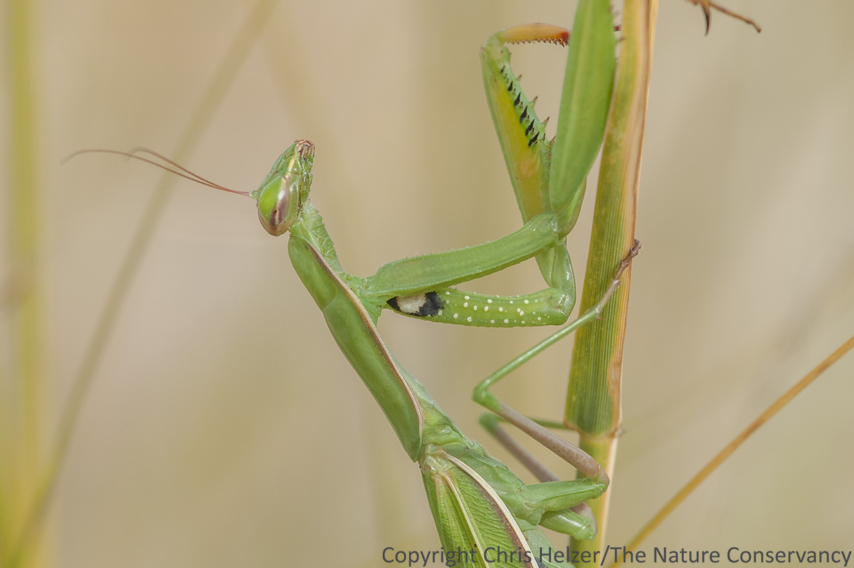
The European mantis (Mantis religiosa). We saw several of these at Bead Mountain, along with other fun critters including a bull snake, glass lizard (I didn’t get to see either of those), a rock wren nest, and lots of black beetles.

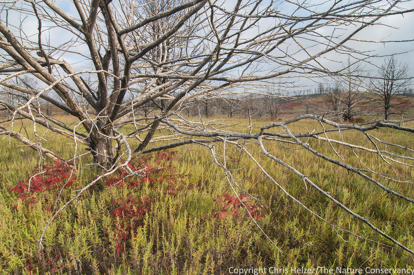
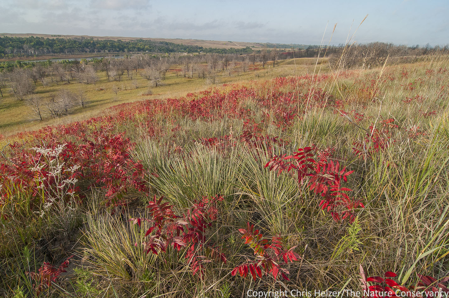
The red fall foliage of skunkbush sumac (Rhus trilobata) provided bright highlights across the Wildcat Hills this week.
More of Bead Mountain Ranch, showing the ponderosa pines on the high rocky slopes. Much of the dominant vegetation at the site is blackroot sedge, aka threadleaf sedge (Carex filifolia).
The Wildcat Hills features an incredible diversity of life because of the wide range of habitats from high rocky outcrops to flowing springs. The prairies are dominated by short and mid-height grasses and sedges such as blackroot sedge, needle-and-thread, western wheatgrass, blue grama, and side-oats grama, but also include taller species such as prairie sandreed and sand bluestem – along with many many wildflowers. Ponderosa pine and rocky mountain juniper trees are native to the bluffs, and are now joined by eastern redcedar, which is not considered native to the landscape, but is now hybridizing with rocky mountain juniper. Cheatgrass has invaded most prairies to one extent or another, but many still maintain very high plant diversity.
Wildlife is abundant in the landscape, including myriad bird species as well as some larger animals such as mountain lions and bighorn sheep. The only thing that keeps the landscape from being overrun with hikers and nature enthusiasts is its distance from large population centers. That’s not such a bad thing – especially for those hardy souls who do make the trip to visit.