Many of you remember previous posts about the wildfire that swept across the Niobrara Valley back in July 2012. About half of The Nature Conservancy’s Niobrara Valley Preserve burned during that event. Through some funding from the Nebraska Environmental Trust Fund and assistance from Moonshell Media, we set up an array of timelapse cameras to document the recovery of our site from that fire.
I’ve spent much of this week looking through many thousands of images from those cameras. The cameras (when they are working properly) take one photo each daylight hour. Between April 2013 and today, that is approximately 14 billion images – or so it seems through my weary and bloodshot eyes. As I’ve been poring through these photos, looking for stories they can tell us, one thing that keeps my fire stoked (so to speak) is the periodic discovery of dramatic light and/or scenes captured by the automated cameras. Today, I’m sharing a selection of those accidental masterpieces taken by one particular camera that was set up to peer downstream from near the top of the bluff north of the Niobrara River.

April 2013, just before the first growing season following the wildfire. The ground was still bare and punctuated by the skeletons of ponderosa pine and eastern red cedar trees killed by the fire.
When we set up this camera, my hope was to watch the re-greening of the hills beneath the dead ponderosa pine and eastern red cedar trees and maybe catch a nice sunrise or two. Both objectives were achieved, along with some other really gorgeous photographs – some of which happened only because the camera malfunctioned.

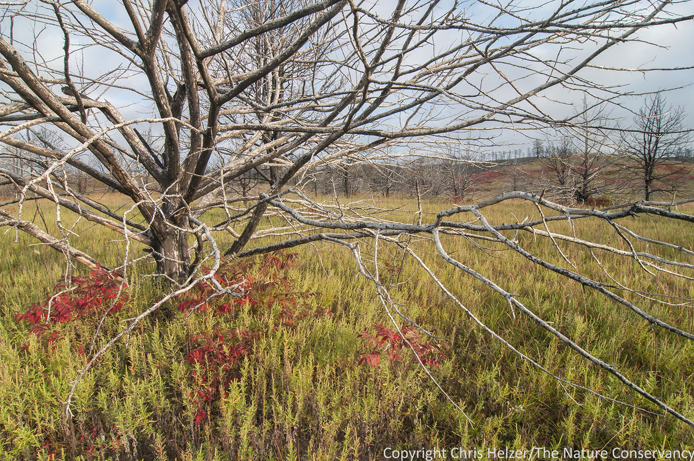
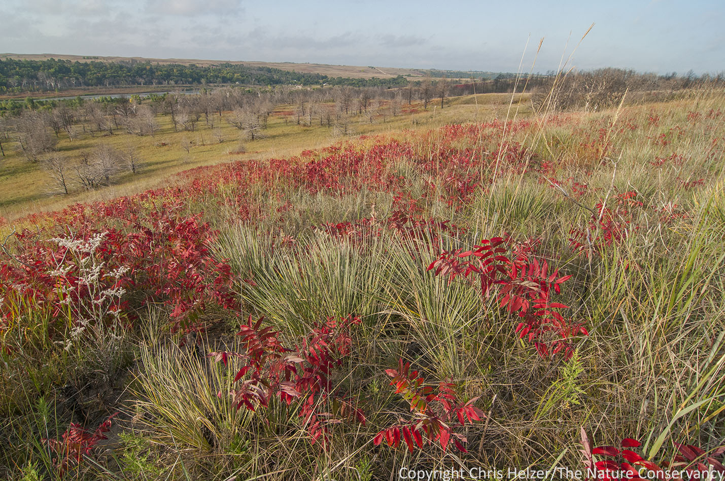
October 2015. This image caps off the third growing season of recovery from the wildfire. Bare slopes have grown a covering of grasses, shrubs, and other plants. Many of the plants seen here are annuals, yet to be replaced by perennials, but those are slowly spreading on the slopes as well. A number of yucca, sumac, and other shrubby plants have regrown from their bases and we are waiting to see how that transition continues.

August 2015. A beautiful foggy morning.

May 2013. This photo wasn’t supposed to have been taken because the camera was only meant to shoot during daylight hours. However, the controller somehow decided to take this photo at 9:13pm and it is a beautiful one.

November 2015. A serene photo taken in the middle of a snowstorm.

December 2013. This is one of the few sunrise photos we got that had much color in the sky.

August 2014. Annual sunflowers dominate the foreground of the image, and they and other annual (and some perennial) plants cover the hills in the background.

August 2014. A foggy morning with the same sunflowers seen in the previous photo., but taken a week earlier.

June 2015. Flowering stalks help highlight the abundance of yucca on a cloudy summer evening.

January 2014. A hazy sunrise on a cold winter morning.

March 2014. Fog, frost, and a sunrise through silhouettes of trees make this my favorite photo of the three years of timelapse images from this camera.
So, there you go. A beautiful series of images that also show what happens following a wildfire. Ecological processes don’t stop after a fire, they just shift into a different gear. We have done nothing to aid or enhance the recovery of the woodland at this site. To this point, we’ve just been watching for signs of trouble – invasive plants that might take advantage of the situation, serious soil erosion issues, etc. There hasn’t yet been any reason to step in and act. Plants and animals are thriving on the slopes shown in these photos, though the composition of those communities has changed pretty dramatically – and continues to change.
Ecological resilience is about the ability of natural systems to absorb shock and keep functioning. The pine woodland is gone from these hills, and it will probably take many decades to show up again because they are pretty far away from unburned pine woodland that could provide seed. In the meantime, we will do our job as land stewards and try to facilitate the most biological diversity we can, using the primary tools available to us – prescribed fire and grazing to manipulate plant competition and habitat structure, and spot-treatment (as needed) with herbicides to control invasives.
We hope to keep these timelapse cameras going for at least several more years. Hopefully, that will help us continue documenting the amazing resilience of nature, and the specific stories playing out at the Niobrara Valley Preserve. If nothing else, we should be at least get some more beautiful, if accidental, photographs to enjoy.