I drove up to the Niobrara Valley Preserve this week and arrived in time for a long hike before dark on Monday evening. It was the kind of opportunity to wander and think that is critically important (but unfortunately rare) for land managers and ecologists. I focused my time north of the river where steep ridges and “foothills” full of pines, bur oaks, prairie, and lots of eastern red cedar trees had experienced an intense summer wildfire during the severe drought of 2012. Since the fire, our staff has been having lots of discussions about how we should be managing the site and its recovery. It was great to have a few hours to just hike around, observe, and think. I took some notes in my field notebook as I walked. Here are a few of those notes (in italics), fleshed out with some of the further thoughts.

A rare fallen ponderosa pine in 2012 wildfire area at TNC’s Niobrara Valley Preserve, Nebraska. Most of the trees killed by the fire are still standing, and probably will be for many years to come. This photo is looking southeast from the hills on the north side of the Niobrara River, where fire intensity was very high and killed nearly every pine and cedar tree.
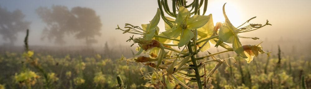
No young cedar or pine trees anywhere.
As we started to assess the impacts of the wildfire, many of my biggest questions had to do with the future of this area north the river, where ponderosa pine and bur oak trees had been abundant, along with an extensive population of eastern red cedar. I knew the Sandhills prairie would recover just fine (and it has), and I figured we wouldn’t see much pine re-establishment for a long time (none so far), but I was most concerned that cedars would re-infest the slopes north of the river faster than we could control them. Because the pines and cedars had been so thick in many areas, I guessed it would be a while before grass colonized sufficiently to support a prescribed burn hot enough to kill cedar trees, and I worried that we’d end up right where we’d been within 10-15 years (except with all cedars and no pines). As it happens, the grass is filling in pretty well in many places, but I haven’t seen a single young cedar tree yet. Researchers from the University of Nebraska-Lincoln, who are helping us study the area, have apparently seen a couple, but they are exceedingly rare. (One of those researchers, graduate student Amanda Hefner, is working to answer many of the questions we have about the recovery of these wooded areas.)
I’ve been talking to other people about their experiences with hot prescribed fires or summer wildfires that wiped out cedar trees in Nebraska grasslands. Typically, without follow-up fire, a dense regrowth of cedars reaches head high or so within about 10 years. Based on what I’m seeing so far, I don’t think we’re going to see that kind of rapid reestablishment. So, why? Did the fire scorch the seed bank? Is the area far enough away from other fruiting cedar trees that it is temporarily safe from reinvasion? I really need to spend some time walking near the edge of the big wildfire to see what the cedar re-invasion looks like there.
The wildfire didn’t appear to affect sumac, plum, or other deciduous shrubs – even in hottest areas.
A big topic in the prescribed fire circles here in Nebraska has been the proposal that we should consider conducting burns in hotter and drier conditions than we usually do. University of Nebraska Range Ecologist, Dirac Twidwell, has been leading this push. Research that Twidwell and others conducted in the southern Plains showed some dramatic positive results from summer burning under severe drought conditions – including mortality of some re-sprouting tree species that hadn’t previously been thought to be susceptible to fire. I’ve been wondering about using hotter summer fires, perhaps during drought conditions, as a way to combat high populations of deciduous trees and shrubs in prairies. Maybe burning under more stressful conditions (for the trees) would reduce their populations? I’m still thinking about that idea, but what I saw at the Niobrara Valley Preserve makes me question how likely we are to see success. Even in areas where cedars and pines experienced crown fires, and fire intensity was at its highest during the July 2012 wildfire (in hot weather, during a severe drought), I don’t see any evidence that sumac or wild plum were hurt at all. I can see the outline of the shrub patches that burned during the fire, and today’s patches are even bigger – and maybe more dense – than they were before the wildfire.

There is a lot to see in this photo. In the foreground, you see strong growth of grasses beneath what had been a big spreading cedar tree that had been shading the ground prior to the fire. If you look closely, you can also see stems of smooth sumac beneath the tree and behind it to the left – a healthy spreading population. In the background, you can see skeletons of pines, oaks, and cedars on grassy hills above the river.
Most bur oaks in steep draws were single trunks before the 2012 wildfire, but out in the open, many were multi-trunk trees. They must have seen at least one big fire in the past?
People who spend more time than I do along the Niobrara may find this to be old news, but I was surprised at how many old bur oaks had multiple trunks prior to the 2012 wildfire – evidence that they’d likely been through a relatively severe fire that had caused them to respond by resprouting from their bases. We should cut a few of those old trunks apart to date that fire. Interestingly, however, those multi-trunk trees seemed to be mainly (exclusively?) outside of the steep draws. Those draws were full of pines and cedars, along with oaks and a few other deciduous trees, and there wasn’t much herbaceous vegetation (grasses, sedges, and forbs) beneath those trees. The combination of steep terrain, lack of herbaceous fuel for fires, and high soil moisture (shade from trees and steep terrain), probably kept previous fires from being intense enough in those areas to top-kill oak trees. However, the 2012 wildfire was a completely different animal, and now nearly all the bur oaks north of the river are starting their growth over from the base. It will be very interesting to see if they all turn into big trees with 4-5 trunks again.

A bur oak at the top edge of a draw. The tree had been growing with five big separate trunks prior to the 2012 wildfire, and is now has many resprouts from its base again. Further down into the draw, all the oaks I found had only one single trunk.
The steepest slopes at the top of ridge are still dominated by annuals. Perennial grasses are filling in well elsewhere, except steep slopes under (formerly) dense cedars and pines.
In general, I’ve been pleasantly surprised by the density of herbaceous vegetation in much of the 2012 wildfire area north of the river. Even where pine and cedar density was fairly high, perennial grasses and sedges are filling in pretty quickly. The thinnest vegetation is in places where topography is particularly steep and where big pines and cedars had been growing most thickly. Where trees were thin or non-existent before the fire, the vegetation responded just as I’d expect prairie to do – there is great plant vigor and species diversity. Where the vegetation had been thinner prior to the fire because shade from trees, today’s plant diversity seems lower, and many patches are dominated by one or two grass species. Species such as sand lovegrass (Eragrostis trichodes) and Scribner’s panicum (Panicum oligosanthes), for example, have formed near monocultures in many places. I think these will diversify over time, so I think it’s great (and interesting) to see them for now.

On this steep east-facing slope of a draw, there is still a lot of bare ground, though perennial sedges and grasses occur here and there. Whatever the particular sedge species in this photo is, it is apparently a favorite of deer because every plant I found had been cropped very short.
However, in those steeper areas, especially near the top of the ridge, perennial grasses and sedges are still very thin, and most vegetation is annuals. This isn’t necessarily a problem, and the annuals seem to do a pretty good job of holding the soil, but it makes me wonder about the speed and eventual trajectory of the plant community recovery in these areas. Mostly, I’m just curious to see what happens, but I’m also a little concerned that we might see some invasive species fill in before native perennials get a foothold. As an example, smooth brome is common in the flats above the ridge, and it’d be a shame if it also gained dominance on the steep slopes below. I’m hopeful that the soil conditions won’t favor brome, but we’ll have to just wait and see.
> > > > > > >
Overall, these observations just add further complexity to discussions our staff has been having about how to manage this area in the future. We still need to decide what we want the area to become so we can guide it in that direction. It’s all fine and good to say we’ll just let it develop however it wants to, but if the site trends toward a cedar woodland with a smooth brome understory, for example, that’s not really going to be very positive for wildlife or biological diversity.
We’d really like to encourage the bur oak trees to survive and thrive but aren’t sure what kind of fire frequency or intensity might best facilitate that. What about deciduous shrubs? Are we ok with letting the current clones become so large and dense that they eliminate grasses beneath them? They would essentially be fireproof at that point, and we’d have no easy way of thinning or otherwise managing them – especially in really steep areas. More importantly, those shrub patches would likely provide safe haven for cedars and other trees to establish and grow within those fireproof shrub clones. Is that what we want? If not, what are our management options? We have lots of ideas, but still have a lot of discussing, researching, and observing to do.
These kinds of questions and challenges are why land management is interesting and fun. I’m really looking forward to watching this area (and all the others I get to help with) continue to develop over the next few decades.